Clarence River fishing map is included in New South Wales Fishing Maps nautical charts folio. It is available as part of iBoating : Australia Marine & Fishing App (now supported on multiple platforms including Android, iPhone/iPad, MacBook, and Windows(tablet and phone)/PC based chartplotter. ).
With our Lake Maps App, you get all the great marine chart app features like fishing spots, along with Clarence River lake depth map. The fishing maps app include HD lake depth contours, along with advanced features found in Fish Finder / Gps Chart Plotter systems, turning your device into a Depth Finder. The Clarence River Navigation App provides advanced features of a Marine Chartplotter including adjusting water level offset and custom depth shading. Fishing spots and depth contours layers are available in most Lake maps. Lake navigation features include advanced instrumentation to gather wind speed direction, water temperature, water depth, and accurate GPS with AIS receivers(using NMEA over TCP/UDP). Autopilot support can be enabled during ‘Goto WayPoint’ and ‘Route Assistance’.
Have more questions about the Nautical Chart App? Ask us.
Fishing Info for Clarence River
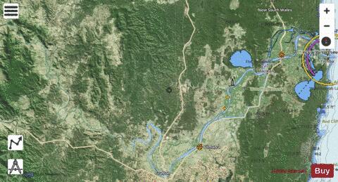
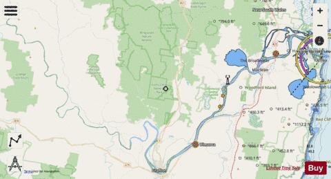
The Clarence River (Bundjalung: Boorimbah, Yaygir: Ngunitiji) is a river situated in the Northern Rivers district of New South Wales, Australia. The river rises on the eastern slopes of the Great Dividing Range, in the Border Ranges west of Bonalbo, near Rivertree at the junction of Koreelah Creek and Maryland River, on the watershed that marks the border between New South Wales and Queensland. The river flows generally south, south east and north east, joined by twenty-four tributaries including the Tooloom Creek and the Mann, Nymboida, Cataract, Orara, Coldstream, Timbarra, and Esk rivers. The river reaches its mouth at its confluence with the Coral Sea in the South Pacific Ocean, between Iluka and Yamba; descending 256 metres (840 ft) over the course of its 394 kilometres (245 mi) length. On its journey it passes through the towns of Tabulam and Copmanhurst, the city of Grafton, and the towns of Ulmarra, and Maclean. The river features many large river islands, including Woodford, Chatsworth, Ashby, Warregah and islands; and Susan Island Nature Reserve. The river supports a large prawn trawling and fishing industry. The Clarence River system is an extensive east coast drainage with many tributaries of differing size. Apart from the Murray River, it is the largest river in mainland Australia south of the Tropic of Capricorn. Its basin is, together with the very similarly-sized Hawkesbury, Australia's largest Pacific watershed south of Bundaberg. The extremely intense rainfalls that typify the North Coast mean, however, that major floods can temporarily raise the flow of the Clarence to 24 feet, as happened in 1890.
More on Wikipedia...Popular fish species in this lake include Eastern freshwater cod.
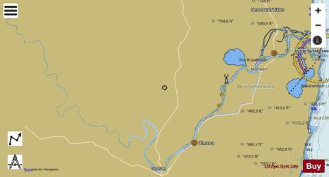
Clarence River Fishing Map Stats | |
| Title | Clarence River |
| Scale | 1:24000 |
| Area * | 15240.63 acres |
| Shoreline * | 274.69 miles |
| Min Longitude | 152.53 |
| Min Latitude | -29.70 |
| Max Longitude | 153.37 |
| Max Latitude | -29.31 |
| Edition Label 1 | |
| Edition Label 2 | |
| Edition Label 3 | |
| Id | AU_NSW_13_Clarence_River |
| Country | Australia |
| Projection | Mercator |
| * some Stats may include nearby/connecting waterbodies | |
| |||||||||||||||||||||||||||||||||||||||||||||||||||||||||||||||||||||||||||||||||||||||||||||||||||||||
|