Argyle Lake fishing map is included in Western Australia nautical charts folio. It is available as part of iBoating : Australia Marine & Fishing App (now supported on multiple platforms including Android, iPhone/iPad, MacBook, and Windows(tablet and phone)/PC based chartplotter. ).
With our Lake Maps App, you get all the great marine chart app features like fishing spots, along with Argyle Lake depth map. The fishing maps app include HD lake depth contours, along with advanced features found in Fish Finder / Gps Chart Plotter systems, turning your device into a Depth Finder. The Argyle Lake Navigation App provides advanced features of a Marine Chartplotter including adjusting water level offset and custom depth shading. Fishing spots and depth contours layers are available in most Lake maps. Lake navigation features include advanced instrumentation to gather wind speed direction, water temperature, water depth, and accurate GPS with AIS receivers(using NMEA over TCP/UDP). Autopilot support can be enabled during ‘Goto WayPoint’ and ‘Route Assistance’.
Have more questions about the Nautical Chart App? Ask us.
Fishing Info for Argyle Lake
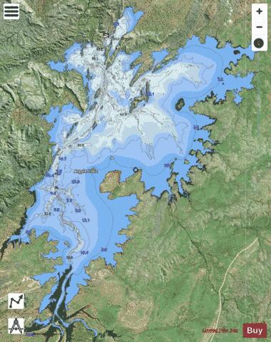
Lake Argyle is Western Australia's largest and Australia's second largest freshwater man-made reservoir by volume. The reservoir is part of the Ord River Irrigation Scheme and is located near the East Kimberley town of Kununurra. The lake flooded large parts of the Shire of Wyndham-East Kimberley on the Kimberley Plateau about 80 kilometres (50 mi) inland from the Joseph Bonaparte Gulf, close to the border with the Northern Territory. The primary inflow is the Ord River, while the Bow River and many other smaller creeks also flow into the dam.The lake is a DIWA-listed wetland. Lake Argyle and Lake Kununurra were listed in 1990 as Ramsar Convention protected wetlands.
More on Wikipedia...Popular fish species in this lake include Barramundi, Bony bream, Sleepy cod and Southern saratoga.
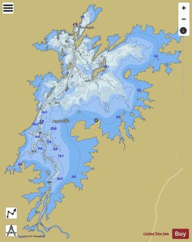
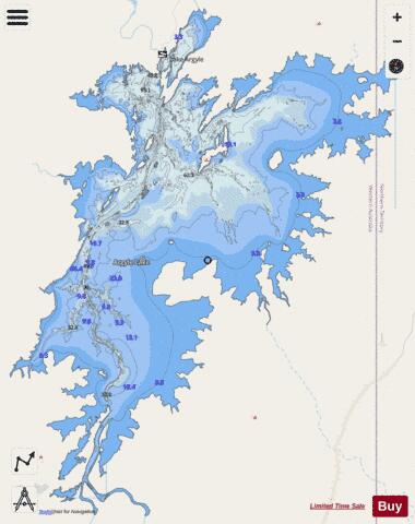
Argyle Lake Fishing Map Stats | |
| Title | Argyle Lake |
| Scale | 1:48000 |
| Area * | 279116.04 acres |
| Shoreline * | 622.18 miles |
| Min Longitude | 128.55 |
| Min Latitude | -16.66 |
| Max Longitude | 129.04 |
| Max Latitude | -16.07 |
| Edition Label 1 | |
| Edition Label 2 | |
| Edition Label 3 | |
| Id | AU_WA_argyle |
| Country | Australia |
| Projection | Mercator |
| * some Stats may include nearby/connecting waterbodies | |
|