Marie Lake fishing map is included in Alberta Lakes nautical charts folio. It is available as part of iBoating : Canada Marine & Fishing App (now supported on multiple platforms including Android, iPhone/iPad, MacBook, and Windows(tablet and phone)/PC based chartplotter. ).
With our Lake Maps App, you get all the great marine chart app features like fishing spots, along with Marie Lake depth map. The fishing maps app include HD lake depth contours, along with advanced features found in Fish Finder / Gps Chart Plotter systems, turning your device into a Depth Finder. The Marie Lake Navigation App provides advanced features of a Marine Chartplotter including adjusting water level offset and custom depth shading. Fishing spots and depth contours layers are available in most Lake maps. Lake navigation features include advanced instrumentation to gather wind speed direction, water temperature, water depth, and accurate GPS with AIS receivers(using NMEA over TCP/UDP). Autopilot support can be enabled during ‘Goto WayPoint’ and ‘Route Assistance’.
Now i-Boating supports Fishing Points in Marie Lake.
Have more questions about the Nautical Chart App? Ask us.
Fishing Info for Marie Lake
Marie Lake is a lake in Alberta. It lies just northwest of the larger Cold Lake. This lake is one of the last clean lakes not effected by oilfield damage to the ecosystem, a beautiful green color water with some of the best fishing in the province.Sightings of pike larger than a man have been noted by divers in the area. Traces of diamonds were found as well, and the government tried to drain lake for mining, but was met with protests and successfully protected. However, looks like they decided to use current conditions to go ahead with it, and we will be lucky to see this beauty in less than a decade or two. * v * t * e
More on Wikipedia...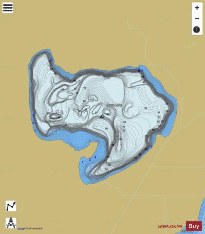
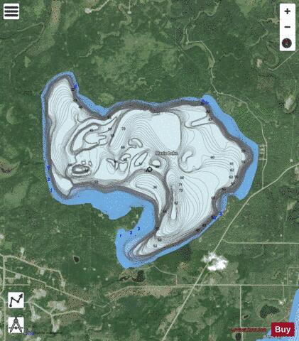
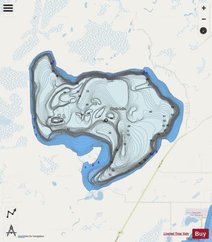
Marie Lake Fishing Map Stats | |
| Title | Marie Lake |
| Scale | 1:12000 |
| Districts | Division No. 12 |
| Nearby Cities | Cold Lake, Grand Centre, Bonnyville, Elk Point |
| Area * | 9234.29 acres |
| Shoreline * | 18.53 miles |
| Min Longitude | -110.36 |
| Min Latitude | 54.59 |
| Max Longitude | -110.23 |
| Max Latitude | 54.66 |
| Edition Label 1 | |
| Edition Label 2 | |
| Edition Label 3 | |
| Id | CA_AB_marie_lake |
| Country | CA |
| Projection | Mercator |
| * some Stats may include nearby/connecting waterbodies | |
|