Trembleur Lake fishing map is included in Lakes and Rivers of British Columbia nautical charts folio. It is available as part of iBoating : Canada Marine & Fishing App (now supported on multiple platforms including Android, iPhone/iPad, MacBook, and Windows(tablet and phone)/PC based chartplotter. ).
With our Lake Maps App, you get all the great marine chart app features like fishing spots, along with Trembleur Lake depth map. The fishing maps app include HD lake depth contours, along with advanced features found in Fish Finder / Gps Chart Plotter systems, turning your device into a Depth Finder. The Trembleur Lake Navigation App provides advanced features of a Marine Chartplotter including adjusting water level offset and custom depth shading. Fishing spots and depth contours layers are available in most Lake maps. Lake navigation features include advanced instrumentation to gather wind speed direction, water temperature, water depth, and accurate GPS with AIS receivers(using NMEA over TCP/UDP). Autopilot support can be enabled during ‘Goto WayPoint’ and ‘Route Assistance’.
Now i-Boating supports Fishing Points in Trembleur Lake.
Have more questions about the Nautical Chart App? Ask us.
Fishing Info for Trembleur Lake
Trembleur Lake is a lake in the Omineca Country of the Central Interior of British Columbia, Canada, northwest of Fort St. James between Stuart Lake and the south end of Takla Lake. It is part of the Nechako Lakes. Its name in the Dakelh language is Dzindlat Bun. It has also been known as Cross Lake. Trembleur Lake Provincial Park is on its north shore, above the Middle River. The reserve settlement of Middle River is at that river's mouth into Trembleur Lake.
More on Wikipedia...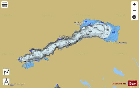
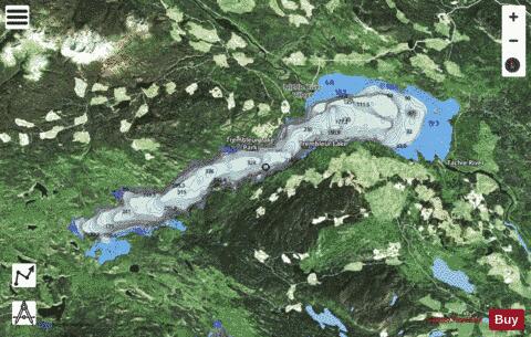
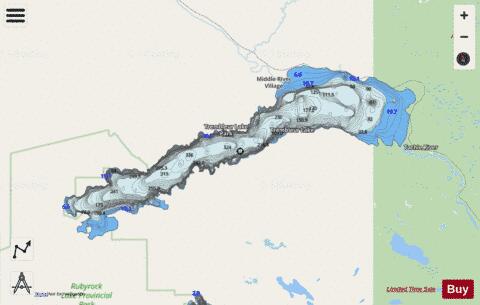
Trembleur Lake Fishing Map Stats | |
| Title | Trembleur Lake |
| Scale | 1:24000 |
| Districts | Bulkley-Nechako |
| Nearby Cities | Burns Lake, Fort St. James |
| Area * | 28706.68 acres |
| Shoreline * | 71.83 miles |
| Min Longitude | -125.41 |
| Min Latitude | 54.75 |
| Max Longitude | -124.94 |
| Max Latitude | 54.88 |
| Edition Label 1 | |
| Edition Label 2 | |
| Edition Label 3 | |
| Id | CA_BC_trembleur_lake_bc |
| Country | CA |
| Projection | Mercator |
| * some Stats may include nearby/connecting waterbodies | |
|