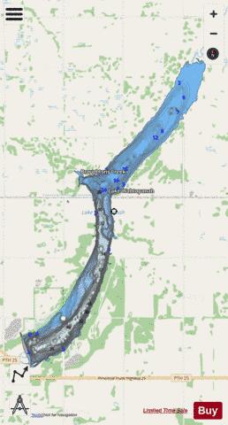
Wahtopanah Lake fishing map is included in Lakes and Rivers in Manitoba nautical charts folio. It is available as part of iBoating : Canada Marine & Fishing App (now supported on multiple platforms including Android, iPhone/iPad, MacBook, and Windows(tablet and phone)/PC based chartplotter. ).
With our Lake Maps App, you get all the great marine chart app features like fishing spots, along with Wahtopanah Lake depth map. The fishing maps app include HD lake depth contours, along with advanced features found in Fish Finder / Gps Chart Plotter systems, turning your device into a Depth Finder. The Wahtopanah Lake Navigation App provides advanced features of a Marine Chartplotter including adjusting water level offset and custom depth shading. Fishing spots and depth contours layers are available in most Lake maps. Lake navigation features include advanced instrumentation to gather wind speed direction, water temperature, water depth, and accurate GPS with AIS receivers(using NMEA over TCP/UDP). Autopilot support can be enabled during ‘Goto WayPoint’ and ‘Route Assistance’.
Now i-Boating supports Fishing Points in Wahtopanah Lake.
Have more questions about the Nautical Chart App? Ask us.
Fishing Info for Wahtopanah Lake
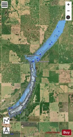
Lake Wahtopanah, also known as Rivers Reservoir, is a lake on the Little Saskatchewan River near the town of Rivers, Manitoba. Its dam was built by the Prairie Farm Rehabilitation Administration in 1960 to supplement water supplies for irrigation. It also provides the water supply for the town of Rivers, stock watering and recreation. The reservoir is about 2,000 feet (610 m) wide and six miles (10 km) long. The deepest point is about 50 feet (15 m). Riparian flows are regulated by a four-foot square gated conduit. High flows pass over a 110-foot (34 m) wide concrete chute spillway. The reservoir stores about 24,500 acre-feet (30,200,000 m3) and covers an area of about 1,580 acres (6.4 km2). The drainage area is about 1,260 square miles (3,300 km2) and extends well into Riding Mountain National Park. The province maintains a park and campground on the west shore.The name is an alternate form of the Native word watopapinah meaning "canoe people". In late June and early July 2020, the area received a 1 in 1000 year runoff event; the flow peaked at about 300 cms (10600 cfs) . The area received over 20 inches of rain over a 5-day period causing the lake to flood to the never before seen level of 471.02 meters (1545.35 feet above sea level), 2.85 meters (9.35 feet) above the full supply level. This also caused the Manitoba Government to lose confidence in the dam and to warn everyone down stream of the likelihood of dam failure and catastrophic flooding. It caused nearby municipalities and the City of Brandon to declare states of emergency and the City of Brandon to put over 2000 residents on evacuation notice. Several near by cabins, homes, and campers in seasonal campground were lost. Once the flood waters receded, the province was able to assess the dam and regain confidence in the structure.
More on Wikipedia...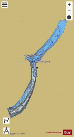
Wahtopanah Lake Fishing Map Stats | |
| Title | Wahtopanah Lake |
| Scale | 1:12000 |
| Nearby Cities | Rivers, Brandon, Minnedosa, Souris, Shilo CFB-BFC, Neepawa, Virden, Boissevain, Carberry, Killarney |
| Area * | 1564.36 acres |
| Shoreline * | 17.48 miles |
| Min Longitude | -100.20 |
| Min Latitude | 50.02 |
| Max Longitude | -100.13 |
| Max Latitude | 50.10 |
| Edition Label 1 | |
| Edition Label 2 | |
| Edition Label 3 | |
| Id | CA_MB_wahtopanah_lake_mb |
| Country | CA |
| Projection | Mercator |
| * some Stats may include nearby/connecting waterbodies | |
|