Wanapitei Lake fishing map is included in Ontario Lakes nautical charts folio. It is available as part of iBoating : Canada Marine & Fishing App (now supported on multiple platforms including Android, iPhone/iPad, MacBook, and Windows(tablet and phone)/PC based chartplotter. ).
With our Lake Maps App, you get all the great marine chart app features like fishing spots, along with Wanapitei Lake depth map. The fishing maps app include HD lake depth contours, along with advanced features found in Fish Finder / Gps Chart Plotter systems, turning your device into a Depth Finder. The Wanapitei Lake Navigation App provides advanced features of a Marine Chartplotter including adjusting water level offset and custom depth shading. Fishing spots and depth contours layers are available in most Lake maps. Lake navigation features include advanced instrumentation to gather wind speed direction, water temperature, water depth, and accurate GPS with AIS receivers(using NMEA over TCP/UDP). Autopilot support can be enabled during ‘Goto WayPoint’ and ‘Route Assistance’.
Now i-Boating supports Fishing Points in Wanapitei Lake.
Have more questions about the Nautical Chart App? Ask us.
Fishing Info for Wanapitei Lake
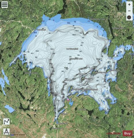
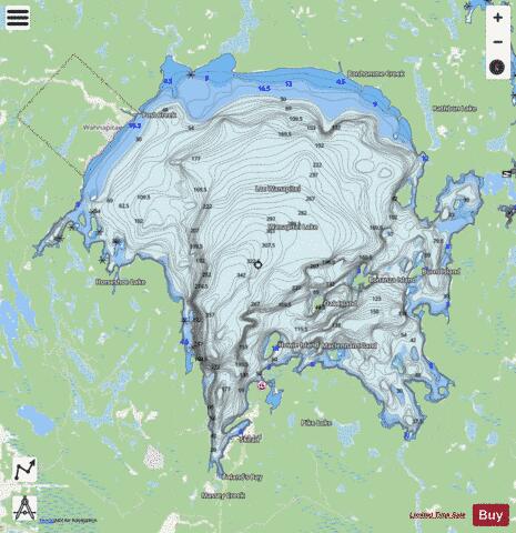
Lake Wanapitei (also known as Lake Wahnapitae) occupies a meteorite crater in Sudbury, Ontario, Canada. It is located near the much larger Sudbury meteorite crater but they are not related. The crater is 5.2 mi (8.4 km) in diameter and the age is estimated to be 37.2 ± 1.2 million years, placing it in the Eocene. It was evident by the mid-1970s that Wanapitei Lake was an impact crater. Remarkably, it lies on the eastern edge of the much older, larger Sudbury structure. Cobbles of suevite, crumbly impact breccia cobbles containing bits of dark glass, are found surrounding the lake. Some contain coesite, a high pressure mineral diagnostic of impact structures. The suevite is very close in appearance and composition to that described from the Ries impact crater. In the 1960s, half a dozen RCMP officers accidentally drowned in the lake during a training exercise. The lake is a popular recreational and residential area in Sudbury, with the neighborhoods of Skead and Boland's Bay located on its shores. With the municipal amalgamation of Greater Sudbury in 2001, it became the largest lake in the world completely contained within the boundaries of a single city. It inherited this status from Lake Ramsey, also in Sudbury. The Wanapitei River flows through the lake. Wanapitei Provincial Park is located on the north shore of Lake Wanapitei — this is a non-operating park so there are no facilities. The lake has a number of small islands within it. Named islands include Blueberry, Howie, Pirate Island, Wanapitei, MacLennan, and Bonanza. Some of the islands are unpopulated, although a few have recreational cottages located on them. The small Wahnapitae Ojibwe reserve is also located on the lake's northwestern shore. The lake's name comes from the Ojibwa word waanabidebiing, or "concave-tooth [shaped] water", which describes its shape. A nearby community which takes its name from the river is spelled Wahnapitae. However, the Wanapitei spelling is correct for both the lake and the river.
More on Wikipedia...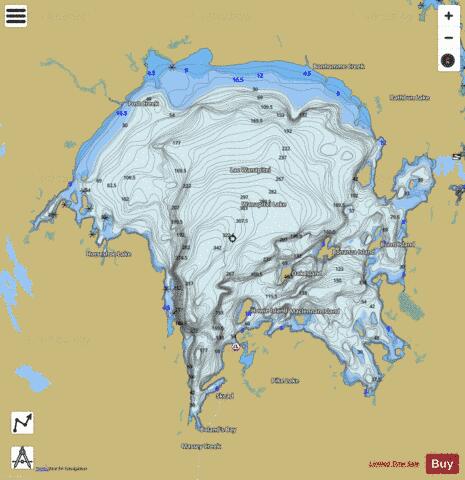
Wanapitei Lake Fishing Map Stats | |
| Title | Wanapitei Lake |
| Scale | 1:24000 |
| Districts | Greater Sudbury / Grand Sudbury |
| Nearby Cities | Capreol, Valley East, Coniston, Sudbury, Azilda, Chelmsford, Lively, Dowling, Sturgeon Falls |
| Area * | 32784.20 acres |
| Shoreline * | 99.73 miles |
| Min Longitude | -80.86 |
| Min Latitude | 46.65 |
| Max Longitude | -80.63 |
| Max Latitude | 46.80 |
| Edition Label 1 | |
| Edition Label 2 | |
| Edition Label 3 | |
| Id | CA_ON_V_103384706 |
| Country | CA |
| Projection | Mercator |
| * some Stats may include nearby/connecting waterbodies | |
|