Pike Lake fishing map is included in Saskatchewan Fishing Maps nautical charts folio. It is available as part of iBoating : Canada Marine & Fishing App (now supported on multiple platforms including Android, iPhone/iPad, MacBook, and Windows(tablet and phone)/PC based chartplotter. ).
With our Lake Maps App, you get all the great marine chart app features like fishing spots, along with Pike Lake depth map. The fishing maps app include HD lake depth contours, along with advanced features found in Fish Finder / Gps Chart Plotter systems, turning your device into a Depth Finder. The Pike Lake Navigation App provides advanced features of a Marine Chartplotter including adjusting water level offset and custom depth shading. Fishing spots and depth contours layers are available in most Lake maps. Lake navigation features include advanced instrumentation to gather wind speed direction, water temperature, water depth, and accurate GPS with AIS receivers(using NMEA over TCP/UDP). Autopilot support can be enabled during ‘Goto WayPoint’ and ‘Route Assistance’.
Now i-Boating supports Fishing Points in Pike Lake.
Have more questions about the Nautical Chart App? Ask us.
Fishing Info for Pike Lake
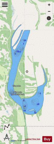
Pike Lake is an oxbow lake of the South Saskatchewan River in the Canadian province of Saskatchewan. It is about 36 km (22 mi) south of downtown Saskatoon in the RM of Vanscoy No. 345 on the west side of the South Saskatchewan River. The lake is in the aspen parkland transitional biome between prairie and boreal forest in Palliser's Triangle. Most of the southern half of the lake is in Pike Lake Provincial Park and access to the lake is from Highways 60 and 766. An unincorporated rural residential community by the same name, Pike Lake, is located on the western shore at the northern boundary of Pike Lake Provincial Park. The community includes a school and a recreation centre. Trees around the lake include aspen, ash, and birch.
More on Wikipedia...Popular fish species in this lake include Northern pike.
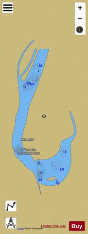

Pike Lake Fishing Map Stats | |
| Title | Pike Lake |
| Scale | 1:12000 |
| Nearby Cities | Saskatoon, Delisle, Martensville, Dalmeny, Warman, Langham, Outlook, Osler, Rosthern |
| Area * | 639.48 acres |
| Shoreline * | 12.91 miles |
| Min Longitude | -106.82 |
| Min Latitude | 51.88 |
| Max Longitude | -106.79 |
| Max Latitude | 51.93 |
| Edition Label 1 | |
| Edition Label 2 | |
| Edition Label 3 | |
| Id | CA_SK_Pike_Lake_sk |
| Country | CA |
| Projection | Mercator |
| * some Stats may include nearby/connecting waterbodies | |
|