Tobin Lake fishing map is included in Saskatchewan Fishing Maps nautical charts folio. It is available as part of iBoating : Canada Marine & Fishing App (now supported on multiple platforms including Android, iPhone/iPad, MacBook, and Windows(tablet and phone)/PC based chartplotter. ).
With our Lake Maps App, you get all the great marine chart app features like fishing spots, along with Tobin Lake depth map. The fishing maps app include HD lake depth contours, along with advanced features found in Fish Finder / Gps Chart Plotter systems, turning your device into a Depth Finder. The Tobin Lake Navigation App provides advanced features of a Marine Chartplotter including adjusting water level offset and custom depth shading. Fishing spots and depth contours layers are available in most Lake maps. Lake navigation features include advanced instrumentation to gather wind speed direction, water temperature, water depth, and accurate GPS with AIS receivers(using NMEA over TCP/UDP). Autopilot support can be enabled during ‘Goto WayPoint’ and ‘Route Assistance’.
Now i-Boating supports Fishing Points in Tobin Lake.
Have more questions about the Nautical Chart App? Ask us.
Fishing Info for Tobin Lake
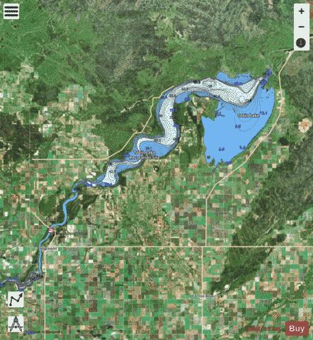
Tobin Lake is a reservoir along the course of the Saskatchewan River in the Canadian province of Saskatchewan. Tobin Lake was formed by the building of the E.B. Campbell Dam on the Saskatchewan River in 1963. The dam was originally named Squaw Rapids Dam, but was renamed E.B. Campbell Dam in 1988 as the term squaw is derogatory. The town of Nipawin is near the western end of the lake and upstream from Nipawin along the Saskatchewan River is , which was formed by the construction of the Francois Finlay Dam in 1986. Situated between these two man-made lakes, Nipawin earned the nickname The Town of Two Lakes. Most of the lake is in the RMs of Moose Range No. 486 and Torch River No. 488; the northernmost shoreline is in the Northern Saskatchewan Administration District. Access to the west and north side of the lake is from Highway 35, the east side from Highway 123, and on the south-west corner from Highway 255. The resort community of Tobin Lake is on the southern shore and spread out along its over 250 kilometres of shoreline are several parks, outfitters, lodges, and campgrounds. The entire lake is an Important Bird Area of Canada.
More on Wikipedia...Popular fish species in this lake include Burbot, Goldeye, Lake sturgeon, Lake whitefish, Longnose sucker, Northern pike, Sauger, Walleye, White sucker and Yellow perch.
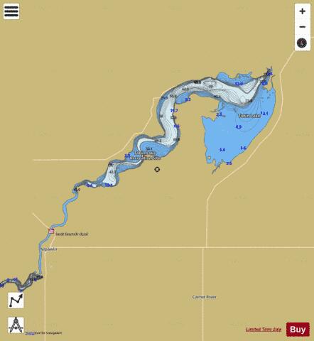
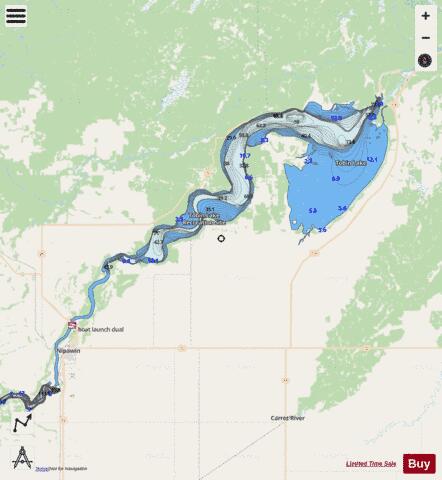
Tobin Lake Fishing Map Stats | |
| Title | Tobin Lake |
| Scale | 1:24000 |
| Nearby Cities | Nipawin, Tisdale, Melfort |
| Area * | 64729.52 acres |
| Shoreline * | 157.56 miles |
| Min Longitude | -104.04 |
| Min Latitude | 53.32 |
| Max Longitude | -103.39 |
| Max Latitude | 53.67 |
| Edition Label 1 | |
| Edition Label 2 | |
| Edition Label 3 | |
| Id | CA_SK_TobinLakeSK |
| Country | CA |
| Projection | Mercator |
| * some Stats may include nearby/connecting waterbodies | |
|