Teslin fishing map is included in Yukon Fishing Maps nautical charts folio. It is available as part of iBoating : Canada Marine & Fishing App (now supported on multiple platforms including Android, iPhone/iPad, MacBook, and Windows(tablet and phone)/PC based chartplotter. ).
With our Lake Maps App, you get all the great marine chart app features like fishing spots, along with Teslin lake depth map. The fishing maps app include HD lake depth contours, along with advanced features found in Fish Finder / Gps Chart Plotter systems, turning your device into a Depth Finder. The Teslin Navigation App provides advanced features of a Marine Chartplotter including adjusting water level offset and custom depth shading. Fishing spots and depth contours layers are available in most Lake maps. Lake navigation features include advanced instrumentation to gather wind speed direction, water temperature, water depth, and accurate GPS with AIS receivers(using NMEA over TCP/UDP). Autopilot support can be enabled during ‘Goto WayPoint’ and ‘Route Assistance’.
Now i-Boating supports Fishing Points in Teslin.
Have more questions about the Nautical Chart App? Ask us.
Fishing Info for Teslin
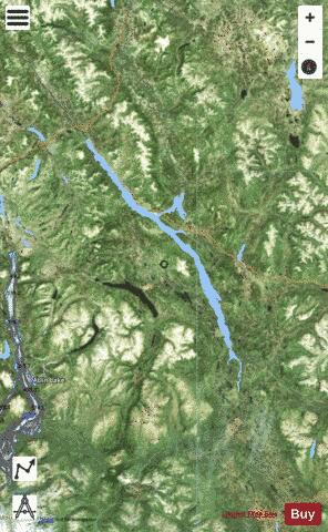
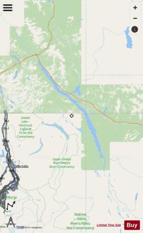
Teslin Lake is a large lake spanning the border between British Columbia and Yukon, Canada. It is one of a group of large lakes in the region of far northwestern BC, east of the upper Alaska Panhandle, which are the southern extremity of the basin of the Yukon River, and which are known in Yukon as "the Southern Lakes" (the other major ones in the group are Atlin Lake and Tagish Lake but include Bennett and Lindeman Lakes, the headwaters of the Yukon River itself). The lake is fed and drained primarily by the Teslin River, south and north, but is also fed from the east by the Jennings River and the Swift River, and from the west by the Hayes River. According to the Yukon Geographical Names Project, "Teslin" means "long water", but in the Tlingit language the local kwaan or tribe of Tlingit is called Deisleen Kwáan", meaning "Big Sinew Tribe". There are three Taku River Tlingit First Nation communities around the south end of the lake in British Columbia: , , and ; in the same area there once was a Hudson's Bay Company trading post. On the Yukon portion of the lake there are three First Nation communities: , , and the Teslin Tlingit Council. The latter is centred in the Village of Teslin, which is located where the Alaska Highway meets the lake, following its northern/eastern shore from there towards Whitehorse. The Nisutlin Plateau limns the eastern side of the lake north of the mouth of the Teslin River and extends into Yukon.
More on Wikipedia...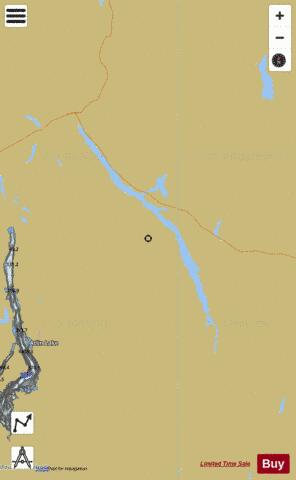
Teslin Fishing Map Stats | |
| Title | Teslin |
| Scale | 1:48000 |
| Districts | Stikine, Yukon |
| Area * | 89423.99 acres |
| Shoreline * | 287.15 miles |
| Min Longitude | -133.26 |
| Min Latitude | 59.49 |
| Max Longitude | -132.08 |
| Max Latitude | 60.46 |
| Edition Label 1 | |
| Edition Label 2 | |
| Edition Label 3 | |
| Id | CA_YT_teslin |
| Country | CA |
| Projection | Mercator |
| * some Stats may include nearby/connecting waterbodies | |
|