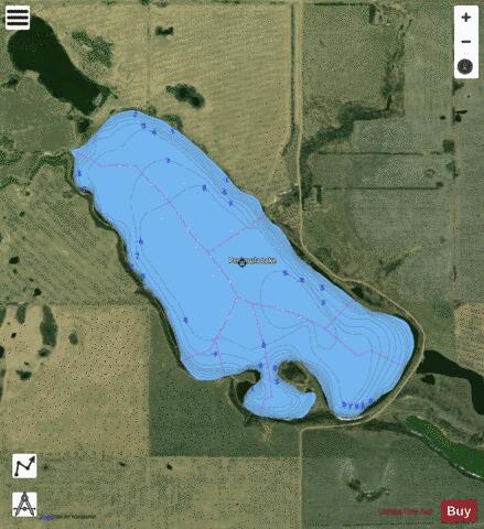
Peninsula Lake fishing map is included in Alberta Lakes nautical charts folio. It is available as part of iBoating : Canada Marine & Fishing App (now supported on multiple platforms including Android, iPhone/iPad, MacBook, and Windows(tablet and phone)/PC based chartplotter. ).
With our Lake Maps App, you get all the great marine chart app features like fishing spots, along with Peninsula Lake depth map. The fishing maps app include HD lake depth contours, along with advanced features found in Fish Finder / Gps Chart Plotter systems, turning your device into a Depth Finder. The Peninsula Lake Navigation App provides advanced features of a Marine Chartplotter including adjusting water level offset and custom depth shading. Fishing spots and depth contours layers are available in most Lake maps. Lake navigation features include advanced instrumentation to gather wind speed direction, water temperature, water depth, and accurate GPS with AIS receivers(using NMEA over TCP/UDP). Autopilot support can be enabled during ‘Goto WayPoint’ and ‘Route Assistance’.
Now i-Boating supports Fishing Points in Peninsula Lake.
Have more questions about the Nautical Chart App? Ask us.
Fishing Info for Peninsula Lake
Peninsula Lake is a lake in Alberta, Canada. The lake is located 160 km southeast of the city of Edmonton. The salinity of Peninsula Lake causes characteristics such as temperature, nutrient concentrations and plant and animal communities to contrast with those from freshwater lakes. The lake is contains high levels of sulphate, sodium and bicarbonate/carbonate concentrations which, are produced by saline groundwater in the region. In winter, the temperature of water under the ice drops to 0 °C, extremely low, even for Alberta lakes. Although the lake contains high mineral levels, plant growth is sparse. A few planktonic invertebrates are exceptionally abundant, but there are fewer species than in freshwater lakes. There are no fish living in the lake. * v * t * e
More on Wikipedia...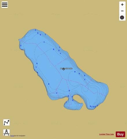
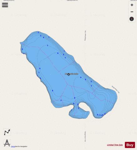
Peninsula Lake Fishing Map Stats | |
| Title | Peninsula Lake |
| Scale | 1:12000 |
| Districts | Division No. 7 |
| Nearby Cities | Viking, Wainwright, Vermilion, Vegreville, Two Hills |
| Area * | 345.11 acres |
| Shoreline * | 3.99 miles |
| Min Longitude | -111.50 |
| Min Latitude | 52.85 |
| Max Longitude | -111.47 |
| Max Latitude | 52.87 |
| Edition Label 1 | |
| Edition Label 2 | |
| Edition Label 3 | |
| Id | CA_AB_Peninsula_Lake_ab |
| Country | CA |
| Projection | Mercator |
| * some Stats may include nearby/connecting waterbodies | |
|