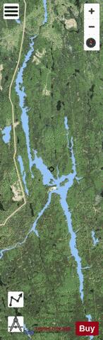
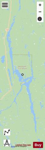
Mattagami Lake fishing map is included in Ontario Lakes nautical charts folio. It is available as part of iBoating : Canada Marine & Fishing App (now supported on multiple platforms including Android, iPhone/iPad, MacBook, and Windows(tablet and phone)/PC based chartplotter. ).
With our Lake Maps App, you get all the great marine chart app features like fishing spots, along with Mattagami Lake depth map. The fishing maps app include HD lake depth contours, along with advanced features found in Fish Finder / Gps Chart Plotter systems, turning your device into a Depth Finder. The Mattagami Lake Navigation App provides advanced features of a Marine Chartplotter including adjusting water level offset and custom depth shading. Fishing spots and depth contours layers are available in most Lake maps. Lake navigation features include advanced instrumentation to gather wind speed direction, water temperature, water depth, and accurate GPS with AIS receivers(using NMEA over TCP/UDP). Autopilot support can be enabled during ‘Goto WayPoint’ and ‘Route Assistance’.
Now i-Boating supports Fishing Points in Mattagami Lake.
Have more questions about the Nautical Chart App? Ask us.
Fishing Info for Mattagami Lake
The Mattagami River is a river in Northern Ontario, Canada. The Mattagami flows 443 kilometres (275 mi) from its source at Mattagami Lake in geographic Gouin Township in the Unorganized North Part of Sudbury District, on the Canadian Shield southwest of Timmins, to Portage Island in geographic Gardiner Township in the Unorganized North Part of Cochrane District, in the Hudson Bay Lowlands. Here the Mattagami's confluence with the Missinaibi River forms the Moose River, about 100 kilometres (60 mi) from that river's tidewater outlet at James Bay. The Mattagami River flows through the city of Timmins as well as the town of Smooth Rock Falls and its drainage basin encompasses 37,000 square kilometres (14,000 sq mi). The Mattagami's name comes from the Ojibwe and means either "the start of water" (maadaagami) or "turbulent water" (madaagami), but the local Ojibwe population claim "Mattagami" is a corrupted form of "confluence" (maadawaagami). According to the Mattagami First Nation, Mattagami means "Meeting of the Waters".
More on Wikipedia...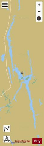
Mattagami Lake Fishing Map Stats | |
| Title | Mattagami Lake |
| Scale | 1:24000 |
| Districts | Sudbury |
| Nearby Cities | Timmins, Porcupine |
| Area * | 10226.88 acres |
| Shoreline * | 192.48 miles |
| Min Longitude | -81.61 |
| Min Latitude | 47.64 |
| Max Longitude | -81.44 |
| Max Latitude | 48.01 |
| Edition Label 1 | |
| Edition Label 2 | |
| Edition Label 3 | |
| Id | CA_ON_CA_ON_V_103412097_on |
| Country | CA |
| Projection | Mercator |
| * some Stats may include nearby/connecting waterbodies | |
| ||||||||||||||||||||||||||||||||||||||||||||||||||||||||||||||||||||||||||||||||||||||||||||||||||||||||
|