Long Lake fishing map is included in Ontario Lakes nautical charts folio. It is available as part of iBoating : Canada Marine & Fishing App (now supported on multiple platforms including Android, iPhone/iPad, MacBook, and Windows(tablet and phone)/PC based chartplotter. ).
With our Lake Maps App, you get all the great marine chart app features like fishing spots, along with Long Lake depth map. The fishing maps app include HD lake depth contours, along with advanced features found in Fish Finder / Gps Chart Plotter systems, turning your device into a Depth Finder. The Long Lake Navigation App provides advanced features of a Marine Chartplotter including adjusting water level offset and custom depth shading. Fishing spots and depth contours layers are available in most Lake maps. Lake navigation features include advanced instrumentation to gather wind speed direction, water temperature, water depth, and accurate GPS with AIS receivers(using NMEA over TCP/UDP). Autopilot support can be enabled during ‘Goto WayPoint’ and ‘Route Assistance’.
Now i-Boating supports Fishing Points in Long Lake.
Have more questions about the Nautical Chart App? Ask us.
Fishing Info for Long Lake
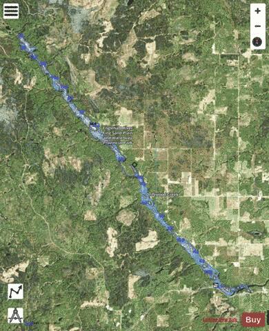
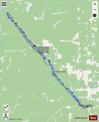
Long Lake is a lake formed by the widening of the Englehart River in Timiskaming District of northeastern Ontario, Canada. The lake is a long, narrow lake that runs generally in a straight line from the northwest to the southeast. The lake spans five geographic townships, beginning in the southeast corner of , then cutting the southwest corner of before diagonally bifurcating into two nearly equal parts. It then cuts through the northeast corner of before entering where it narrows. The small community of can be found on the northeast bank of the lake in Robillard Township. and Glenvale are also nearby communities. The closest town is Charlton which is located further down the Englehart River. The lake is about 24 km in length. The borders the northwestern third of the lake.
More on Wikipedia...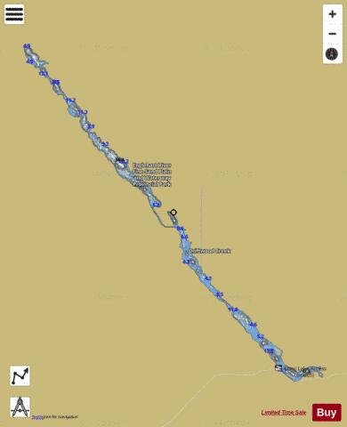
Long Lake Fishing Map Stats | |
| Title | Long Lake |
| Scale | 1:24000 |
| Districts | Timiskaming |
| Nearby Cities | Englehart, Kirkland Lake, New Liskeard, Cobalt, Haileybury, Ville-Marie, Iroquois Falls |
| Area * | 2257.20 acres |
| Shoreline * | 39.39 miles |
| Min Longitude | -80.28 |
| Min Latitude | 47.78 |
| Max Longitude | -80.07 |
| Max Latitude | 47.94 |
| Edition Label 1 | |
| Edition Label 2 | |
| Edition Label 3 | |
| Id | CA_ON_V_105832932 |
| Country | CA |
| Projection | Mercator |
| * some Stats may include nearby/connecting waterbodies | |
| ||||||||||||||||||||||||||||||||||||||||||||||||||||||||||||||||||||||||||||||||||||||||||||||||||||||||
|