Tinnsj√• fishing map is included in √ėstfold nautical charts folio. It is available as part of iBoating : Norway Marine & Fishing App (now supported on multiple platforms including Android, iPhone/iPad, MacBook, and Windows(tablet and phone)/PC based chartplotter. ).
With our Lake Maps App, you get all the great marine chart app features like fishing spots, along with Tinnsj√• lake depth map. The fishing maps app include HD lake depth contours, along with advanced features found in Fish Finder / Gps Chart Plotter systems, turning your device into a Depth Finder. The Tinnsj√• Navigation App provides advanced features of a Marine Chartplotter including adjusting water level offset and custom depth shading. Fishing spots and depth contours layers are available in most Lake maps. Lake navigation features include advanced instrumentation to gather wind speed direction, water temperature, water depth, and accurate GPS with AIS receivers(using NMEA over TCP/UDP). Autopilot support can be enabled during ‚ÄėGoto WayPoint‚Äô and ‚ÄėRoute Assistance‚Äô.
Have more questions about the Nautical Chart App? Ask us.
Fishing Info for Tinnsjå
Tinnsj√• (English: Lake Tinn), also called Tinnsj√ł and Tinnsj√łen, is one of the largest lakes in Norway, and one of the deepest in Europe. It is located between the municipalities of Tinn and Notodden in Vestfold og Telemark county. At its source in the west, the M√•na river flows out of M√łsvatn and past Rjukan into Tinnsj√•. From the north, the river flows from the , , and Kalhovdfjorden lakes into Tinnsj√•. Tinnsj√• is part of the , and drains via the Tinnelva river in the south, down to Heddalsvatn. In 1944, during the German occupation of Norway, the ferry SF Hydro was sunk in Tinnsj√• by the Norwegian resistance. The Germans were using the ferry to transport a large quantity of heavy water to Germany, where it was to be used for nuclear weapon research. The heavy water had been produced at Vemork, a factory located in Rjukan. The wreck of the ferry was discovered in 1993. In 2004, it was investigated and filmed for an episode of NOVA; heavy water samples were recovered and deuterium isotopic enrichment was confirmed. In 2004 a film crew shooting footage for a new documentary on the heavy water sabotage became aware of an unusual fish, swimming near the lake bottom at a depth of 430 m. Two specimens of the previously unknown fish were captured in April 2005. Analysis revealed the fish to be closely related to Arctic char. The light-colored, translucent fish is up to 15 cm long and lacks a swim bladder.
More on Wikipedia...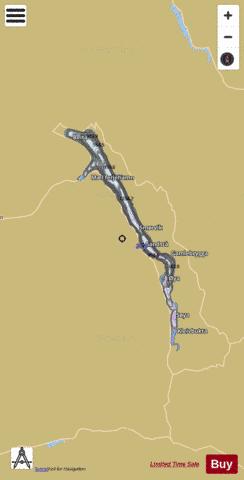
Tinnsjå Fishing Map Stats | |
| Title | Tinnsjå |
| Scale | 1:24000 |
| Min Longitude | 8.76 |
| Min Latitude | 59.72 |
| Max Longitude | 9.04 |
| Max Latitude | 59.99 |
| Edition Label 1 | |
| Edition Label 2 | |
| Edition Label 3 | |
| Id | NO_LK_2 |
| Country | Norway |
| Projection | Mercator |
| * some Stats may include nearby/connecting waterbodies | |
|