Strondafjorden fishing map is included in √ėstfold nautical charts folio. It is available as part of iBoating : Norway Marine & Fishing App (now supported on multiple platforms including Android, iPhone/iPad, MacBook, and Windows(tablet and phone)/PC based chartplotter. ).
With our Lake Maps App, you get all the great marine chart app features like fishing spots, along with Strondafjorden lake depth map. The fishing maps app include HD lake depth contours, along with advanced features found in Fish Finder / Gps Chart Plotter systems, turning your device into a Depth Finder. The Strondafjorden Navigation App provides advanced features of a Marine Chartplotter including adjusting water level offset and custom depth shading. Fishing spots and depth contours layers are available in most Lake maps. Lake navigation features include advanced instrumentation to gather wind speed direction, water temperature, water depth, and accurate GPS with AIS receivers(using NMEA over TCP/UDP). Autopilot support can be enabled during ‚ÄėGoto WayPoint‚Äô and ‚ÄėRoute Assistance‚Äô.
Have more questions about the Nautical Chart App? Ask us.
Fishing Info for Strondafjorden
Strondafjorden (lit.‚ÄČ'Stronda Fjord') is a lake which lies in the municipalities of Nord-Aurdal and Vestre Slidre in Innlandet county, Norway. The lake is part of the Begna watershed. The 13.4-square-kilometre (5.2 sq mi) lake sits at an elevation of 355 metres (1,165 ft) above sea level and it has a circumference of 46 kilometres (29 mi). The town of Fagernes is located at the southeast end of the lake. The northwest end of the lake is crossed by the Ulnes Bridge in the village of R√łn. The European route E16 highway runs along the north shore of the lake, for its whole length. The Strondafjorden is a reservoir for the Faslefoss hydroelectric power plant. In 1919, a dam was built at the south end of the lake to regulate the lake for power production. At the outlet of the dam, there is the 37-metre (121 ft) tall Faslefoss waterfall.
More on Wikipedia...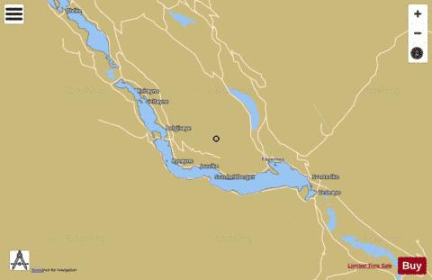
Strondafjorden Fishing Map Stats | |
| Title | Strondafjorden |
| Scale | 1:24000 |
| Min Longitude | 9.05 |
| Min Latitude | 60.96 |
| Max Longitude | 9.29 |
| Max Latitude | 61.03 |
| Edition Label 1 | |
| Edition Label 2 | |
| Edition Label 3 | |
| Id | NO_LK_515 |
| Country | Norway |
| Projection | Mercator |
| * some Stats may include nearby/connecting waterbodies | |
|