Unkervatnet fishing map is included in Østfold nautical charts folio. It is available as part of iBoating : Norway Marine & Fishing App (now supported on multiple platforms including Android, iPhone/iPad, MacBook, and Windows(tablet and phone)/PC based chartplotter. ).
With our Lake Maps App, you get all the great marine chart app features like fishing spots, along with Unkervatnet lake depth map. The fishing maps app include HD lake depth contours, along with advanced features found in Fish Finder / Gps Chart Plotter systems, turning your device into a Depth Finder. The Unkervatnet Navigation App provides advanced features of a Marine Chartplotter including adjusting water level offset and custom depth shading. Fishing spots and depth contours layers are available in most Lake maps. Lake navigation features include advanced instrumentation to gather wind speed direction, water temperature, water depth, and accurate GPS with AIS receivers(using NMEA over TCP/UDP). Autopilot support can be enabled during ‘Goto WayPoint’ and ‘Route Assistance’.
Have more questions about the Nautical Chart App? Ask us.
Fishing Info for Unkervatnet
Unkervatnet (Norwegian) or Åanghkejaevrie (Southern Sami) is a lake in the municipality of Hattfjelldal in Nordland county, Norway. It is a good lake for fishing lake trout and Arctic char both during summer and winter. The river flowing into the lake from the east is called Skarmodalselva, and the outflowing river is called Unkerelva (which itself flows into the river Vefsna). For tourists, there are two places available by the shoreside: Ørnes camping at the eastern end of the lake, and Tjolmen, situated on the north side of the lake's middle. The road from the village of Hattfjelldal to the village of in Sweden runs along the north side of the lake.
More on Wikipedia...Popular fish species in this lake include Arctic char and Lake trout.
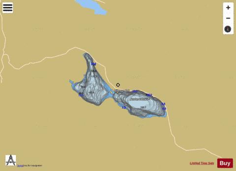
Unkervatnet Fishing Map Stats | |
| Title | Unkervatnet |
| Scale | 1:24000 |
| Min Longitude | 14.14 |
| Min Latitude | 65.49 |
| Max Longitude | 14.31 |
| Max Latitude | 65.54 |
| Edition Label 1 | |
| Edition Label 2 | |
| Edition Label 3 | |
| Id | NO_LK_469 |
| Country | Norway |
| Projection | Mercator |
| * some Stats may include nearby/connecting waterbodies | |
|