Lake of the Isles fishing map is available as part of iBoating : USA Marine & Fishing App(now supported on multiple platforms including Android, iPhone/iPad, MacBook, and Windows(tablet and phone)/PC based chartplotter.).
With our Lake Maps App, you get all the great marine chart app features like fishing spots, along with Lake of the Isles depth map. The fishing maps app include HD lake depth contours, along with advanced features found in Fish Finder / Gps Chart Plotter systems, turning your device into a Depth Finder. The Lake of the Isles Navigation App provides advanced features of a Marine Chartplotter including adjusting water level offset and custom depth shading. Fishing spots and depth contours layers are available in most Lake maps. Lake navigation features include advanced instrumentation to gather wind speed direction, water temperature, water depth, and accurate GPS with AIS receivers(using NMEA over TCP/UDP). Autopilot support can be enabled during ‘Goto WayPoint’ and ‘Route Assistance’.
Now i-Boating supports Fishing Points in Lake of the Isles.
Have more questions about the Nautical Chart App? Ask us.
Fishing Info for Lake of the Isles
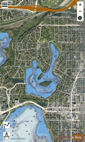
Lake of the Isles (Dakota: Wíta Tópa, "Four Islands") is a lake in Minneapolis, Minnesota, United States, connected to Cedar Lake and Bde Maka Ska. The lake has an area of 109 acres (0.4 km2), 2.86 miles (4.6 km) of shoreline with a little under three miles of paved walking and biking paths, and a maximum depth of 31 feet (9 m). Lake of the Isles is known for its two wooded islands, its long north arm, and the surrounding stately houses of the Kenwood, Lowry Hill, and East Isles neighborhoods.
More on Wikipedia...Popular fish species in this lake include Black bullhead, Black crappie, Bowfin, Common carp, Largemouth bass, Northern pike, Pumpkinseed, Tiger muskellunge, Walleye, Yellow bullhead and Yellow perch.
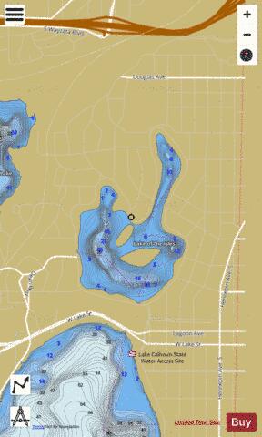
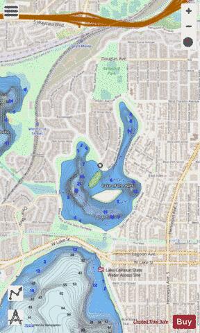
Lake of the Isles Fishing Map Stats | |
| Title | Lake of the Isles |
| Scale | 1:3000 |
| Counties | Hennepin |
| Nearby Cities | Saint Louis Park, Minneapolis, Golden Valley, Richfield, Edina, Robbinsdale, Columbia Heights, Crystal, Saint Anthony, Lauderdale |
| Area * | 111.85 acres |
| Shoreline * | 3.40 miles |
| Min Longitude | -93.31 |
| Min Latitude | 44.95 |
| Max Longitude | -93.30 |
| Max Latitude | 44.96 |
| Edition Label 1 | |
| Edition Label 2 | |
| Edition Label 3 | |
| Id | US_MN_27004000 |
| Country | US |
| Projection | Mercator |
| * some Stats may include nearby/connecting waterbodies | |
|