Washington fishing map is available as part of iBoating : USA Marine & Fishing App(now supported on multiple platforms including Android, iPhone/iPad, MacBook, and Windows(tablet and phone)/PC based chartplotter.).
With our Lake Maps App, you get all the great marine chart app features like fishing spots, along with Washington lake depth map. The fishing maps app include HD lake depth contours, along with advanced features found in Fish Finder / Gps Chart Plotter systems, turning your device into a Depth Finder. The Washington Navigation App provides advanced features of a Marine Chartplotter including adjusting water level offset and custom depth shading. Fishing spots and depth contours layers are available in most Lake maps. Lake navigation features include advanced instrumentation to gather wind speed direction, water temperature, water depth, and accurate GPS with AIS receivers(using NMEA over TCP/UDP). Autopilot support can be enabled during ‘Goto WayPoint’ and ‘Route Assistance’.
Now i-Boating supports Fishing Points in Washington.
Have more questions about the Nautical Chart App? Ask us.
Fishing Info for Washington
Lake Washington is a lake in Le Sueur County, Minnesota and Blue Earth County, Minnesota, in the United States. The lake has a regional park, located on the northwest shore, which was acquired in two phases in 1971 and 1978. The park serves as a campgrounds area. The first structure on the lake was built in 1898. The lake has a summer camp for children on the lake, Camp Patterson, which hosts an average of 2,500 kids throughout the summer. Lake Washington was named for President George Washington.
More on Wikipedia...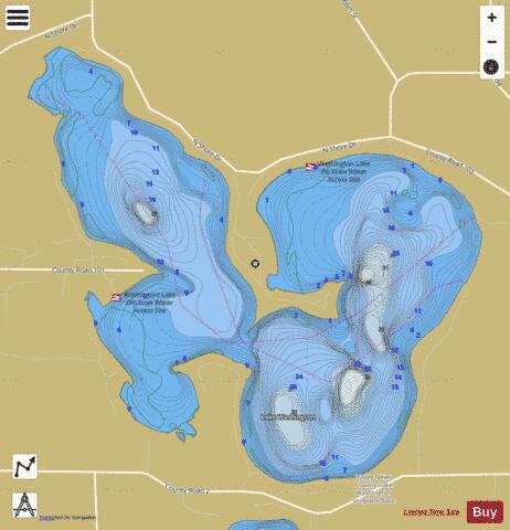
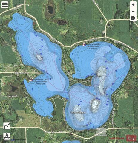
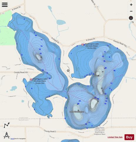
Washington Fishing Map Stats | |
| Title | Washington |
| Scale | 1:6000 |
| Counties | Blue Earth, Le Sueur |
| Nearby Cities | Madison Lake, Cleveland, Kasota, Eagle Lake, Saint Peter, Ottawa, Mankato, Traverse, Saint Clair, North Mankato |
| Area * | 1520.50 acres |
| Shoreline * | 11.91 miles |
| Min Longitude | -93.90 |
| Min Latitude | 44.24 |
| Max Longitude | -93.85 |
| Max Latitude | 44.27 |
| Edition Label 1 | |
| Edition Label 2 | |
| Edition Label 3 | |
| Id | US_MN_40011700 |
| Country | US |
| Projection | Mercator |
| * some Stats may include nearby/connecting waterbodies | |
|