Whale Lake fishing map is available as part of iBoating : USA Marine & Fishing App(now supported on multiple platforms including Android, iPhone/iPad, MacBook, and Windows(tablet and phone)/PC based chartplotter.).
With our Lake Maps App, you get all the great marine chart app features like fishing spots, along with Whale Lake depth map. The fishing maps app include HD lake depth contours, along with advanced features found in Fish Finder / Gps Chart Plotter systems, turning your device into a Depth Finder. The Whale Lake Navigation App provides advanced features of a Marine Chartplotter including adjusting water level offset and custom depth shading. Fishing spots and depth contours layers are available in most Lake maps. Lake navigation features include advanced instrumentation to gather wind speed direction, water temperature, water depth, and accurate GPS with AIS receivers(using NMEA over TCP/UDP). Autopilot support can be enabled during ‘Goto WayPoint’ and ‘Route Assistance’.
Now i-Boating supports Fishing Points in Whale Lake.
Have more questions about the Nautical Chart App? Ask us.
Fishing Info for Whale Lake
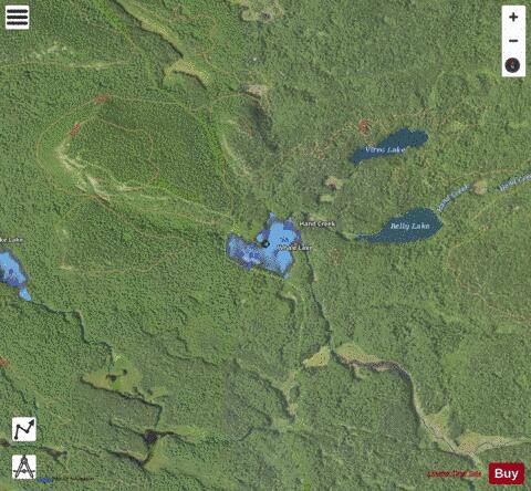
Whale Lake is a lake in Cook County in what is known as the Arrowhead Region of northern Minnesota. It is within the Boundary Waters Canoe Area Wilderness of the Superior National Forest, at the base of Eagle Mountain, Minnesota's highest point. Two miles (3 km) from the nearest road, Whale Lake is only accessible via the Eagle Mountain Hiking Trail from the south, or the Brule Lake Trail from the northwest. It offers two campsites to hikers, one on the northern shore near the intersection of the two trails, and the other a few hundred yards away from the western shore. Whale Lake has been known to contain Bluegill, Northern Pike, Yellow Perch, and more commonly, White Sucker fish. * Whale Lake, on an early Spring day * Looking southeast over Whale Lake * Looking south across Whale Lake. Campsite in the foreground. * Looking southwest across Whale Lake
More on Wikipedia...Popular fish species in this lake include White sucker.
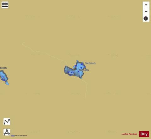
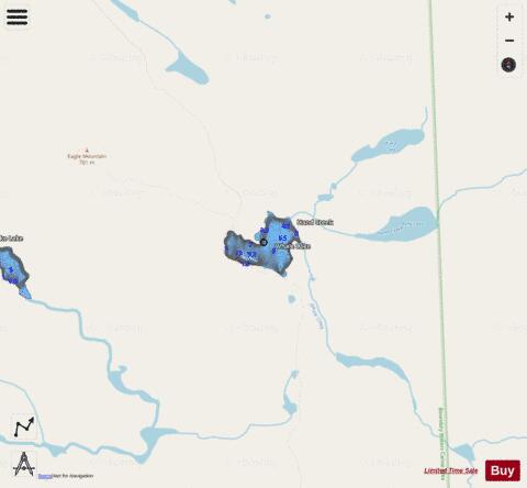
Whale Lake Fishing Map Stats | |
| Title | Whale Lake |
| Scale | 1:3000 |
| Counties | Cook |
| Nearby Cities | Grand Marais, Lutsen, Tofte, Schroeder, Taconite Harbor, Hovland, Little Marais, Forest Center, Pigeon River, Finland |
| Area * | 23.80 acres |
| Shoreline * | 1.08 miles |
| Min Longitude | -90.55 |
| Min Latitude | 47.89 |
| Max Longitude | -90.54 |
| Max Latitude | 47.89 |
| Edition Label 1 | |
| Edition Label 2 | |
| Edition Label 3 | |
| Id | US_AA_MN_16029100_mn |
| Country | US |
| Projection | Mercator |
| * some Stats may include nearby/connecting waterbodies | |
|