Mashapaug Lake fishing map is available as part of iBoating : USA Marine & Fishing App(now supported on multiple platforms including Android, iPhone/iPad, MacBook, and Windows(tablet and phone)/PC based chartplotter.).
With our Lake Maps App, you get all the great marine chart app features like fishing spots, along with Mashapaug Lake depth map. The fishing maps app include HD lake depth contours, along with advanced features found in Fish Finder / Gps Chart Plotter systems, turning your device into a Depth Finder. The Mashapaug Lake Navigation App provides advanced features of a Marine Chartplotter including adjusting water level offset and custom depth shading. Fishing spots and depth contours layers are available in most Lake maps. Lake navigation features include advanced instrumentation to gather wind speed direction, water temperature, water depth, and accurate GPS with AIS receivers(using NMEA over TCP/UDP). Autopilot support can be enabled during ‘Goto WayPoint’ and ‘Route Assistance’.
Now i-Boating supports Fishing Points in Mashapaug Lake.
Have more questions about the Nautical Chart App? Ask us.
Fishing Info for Mashapaug Lake
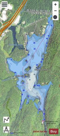
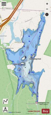
Mashapaug Lake is a 297-acre (1.20 km2) lake surrounded by Bigelow Hollow State Park and Nipmuck State Forest in the town of Union in northeastern Connecticut. The lake has a maximum depth of 39.5 feet (12.0 meters), and an average depth of 15 feet (4.6 meters). Its normal surface elevation is 706 feet. The lake is very popular with fishermen and boaters from the area, and can also be used for swimming.
More on Wikipedia...Popular fish species in this lake include Chain pickerel, Largemouth bass, Rainbow trout, Smallmouth bass and Yellow perch.
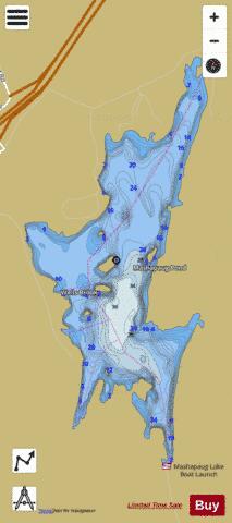
Mashapaug Lake Fishing Map Stats | |
| Title | Mashapaug Lake |
| Scale | 1:12000 |
| Counties | Tolland |
| Nearby Cities | Union, Holland, Fiskdale, Sturbridge, Wales, Southbridge, Eastford, Brimfield, Ashford, Stafford |
| Area * | 297.92 acres |
| Shoreline * | 7.22 miles |
| Min Longitude | -72.14 |
| Min Latitude | 42.01 |
| Max Longitude | -72.13 |
| Max Latitude | 42.03 |
| Edition Label 1 | |
| Edition Label 2 | |
| Edition Label 3 | |
| Id | US_CT_ctserv_mashapaug_lake |
| Country | US |
| Projection | Mercator |
| * some Stats may include nearby/connecting waterbodies | |
|