LAKE EASY fishing map is available as part of iBoating : USA Marine & Fishing App(now supported on multiple platforms including Android, iPhone/iPad, MacBook, and Windows(tablet and phone)/PC based chartplotter.).
With our Lake Maps App, you get all the great marine chart app features like fishing spots, along with LAKE EASY depth map. The fishing maps app include HD lake depth contours, along with advanced features found in Fish Finder / Gps Chart Plotter systems, turning your device into a Depth Finder. The LAKE EASY Navigation App provides advanced features of a Marine Chartplotter including adjusting water level offset and custom depth shading. Fishing spots and depth contours layers are available in most Lake maps. Lake navigation features include advanced instrumentation to gather wind speed direction, water temperature, water depth, and accurate GPS with AIS receivers(using NMEA over TCP/UDP). Autopilot support can be enabled during ‘Goto WayPoint’ and ‘Route Assistance’.
Now i-Boating supports Fishing Points in LAKE EASY.
Have more questions about the Nautical Chart App? Ask us.
Fishing Info for LAKE EASY
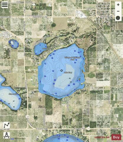
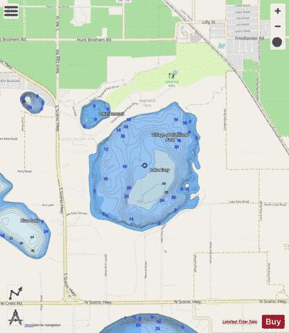
Lake Easy is a natural freshwater lake with a 407-acre (1,650,000 m2) surface area. The lake is somewhat oval in shape and sometimes has a small island in its southeast part, depending on the lake level at the time. Lake Easy is bounded on its north by the incorporated village of Highland Park, which is also a golf resort. On its west side is grassland and a residential development. To the southwest are a citrus orchard and pastureland. On the southeast is residential housing along Lake Easy Road. Along its east side is public land. Lake Easy has no public swimming area. It does, however, have a public boat ramp on the east side. This ramp can be accessed by a sand road that appears by satellite image to come from Lake Easy Road or Underpass Road. A 2008 news story in The Ledger newspaper said the ramp is on Muncie Road, which does not appear on maps. This lake may be fished near the boat ramp or by boats on the lake. The Hook and Bullet website says the lake contains black drum, bigmouth buffalo and atlantic salmon.
More on Wikipedia...Popular fish species in this lake include Atlantic salmon.
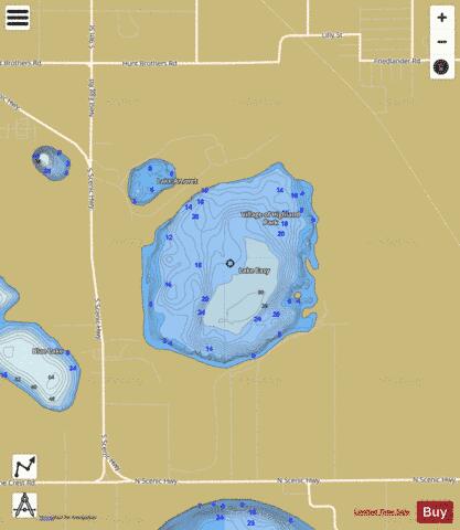
LAKE EASY Fishing Map Stats | |
| Title | LAKE EASY |
| Scale | 1:6000 |
| 1 ft Depth Contours for Anglers | Yes |
| Counties | Polk |
| Nearby Cities | Highland Park, Babson Park, Hillcrest Heights, Lake Wales, Alcoma, West Lake Wales, Frostproof, West Frostproof, Waverly, Alturas |
| Area * | 406.80 acres |
| Shoreline * | 3.51 miles |
| Min Longitude | -81.57 |
| Min Latitude | 27.85 |
| Max Longitude | -81.56 |
| Max Latitude | 27.87 |
| Edition Label 1 | |
| Edition Label 2 | |
| Edition Label 3 | |
| Id | US_FL_00282050 |
| Country | US |
| Projection | Mercator |
| * some Stats may include nearby/connecting waterbodies | |
|