Mille Lacs fishing map is available as part of iBoating : USA Marine & Fishing App(now supported on multiple platforms including Android, iPhone/iPad, MacBook, and Windows(tablet and phone)/PC based chartplotter.).
With our Lake Maps App, you get all the great marine chart app features like fishing spots, along with Mille Lacs lake depth map. The fishing maps app include HD lake depth contours, along with advanced features found in Fish Finder / Gps Chart Plotter systems, turning your device into a Depth Finder. The Mille Lacs Navigation App provides advanced features of a Marine Chartplotter including adjusting water level offset and custom depth shading. Fishing spots and depth contours layers are available in most Lake maps. Lake navigation features include advanced instrumentation to gather wind speed direction, water temperature, water depth, and accurate GPS with AIS receivers(using NMEA over TCP/UDP). Autopilot support can be enabled during ‘Goto WayPoint’ and ‘Route Assistance’.
Now i-Boating supports Fishing Points in Mille Lacs.
Have more questions about the Nautical Chart App? Ask us.
Fishing Info for Mille Lacs
Mille Lacs Lake (also called Lake Mille Lacs or Mille Lacs) is a large but shallow lake in the U.S. state of Minnesota. It is located in the counties of Mille Lacs, Aitkin, and Crow Wing, roughly 75 miles north of the Minneapolis-St. Paul metropolitan area. Mille Lacs means "thousand lakes" in French. In the Ojibwe language of the people who historically occupied this area, the lake is called Misi-zaaga'igan ("grand lake").
More on Wikipedia...Popular fish species in this lake include Black crappie, Burbot, Largemouth bass, Northern pike, Smallmouth bass, Walleye and Yellow perch.
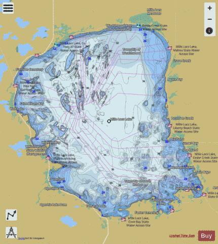
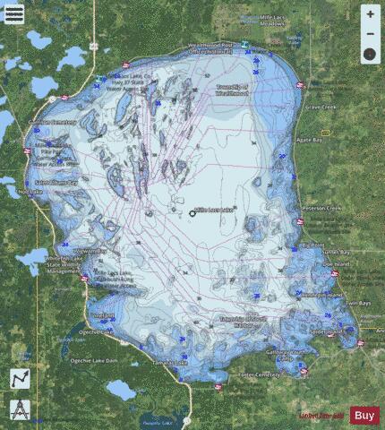
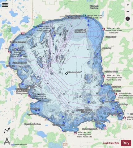
Mille Lacs Fishing Map Stats | |
| Title | Mille Lacs |
| Scale | 1:48000 |
| Counties | Aitkin, Crow Wing, Mille Lacs |
| Nearby Cities | Isle, Vineland, Garrison, Wahkon, Malmo, Onamia, Glen, Pine Center, Aitkin, Deerwood |
| Area * | 128218.54 acres |
| Shoreline * | 106.00 miles |
| Min Longitude | -93.82 |
| Min Latitude | 46.11 |
| Max Longitude | -93.46 |
| Max Latitude | 46.37 |
| Edition Label 1 | |
| Edition Label 2 | |
| Edition Label 3 | |
| Id | US_MN_48000200 |
| Country | US |
| Projection | Mercator |
| * some Stats may include nearby/connecting waterbodies | |
|