Echo Lake fishing map is available as part of iBoating : USA Marine & Fishing App(now supported on multiple platforms including Android, iPhone/iPad, MacBook, and Windows(tablet and phone)/PC based chartplotter.).
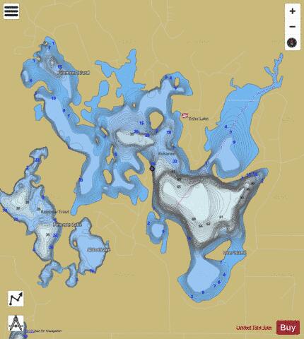
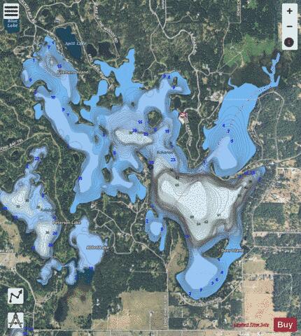
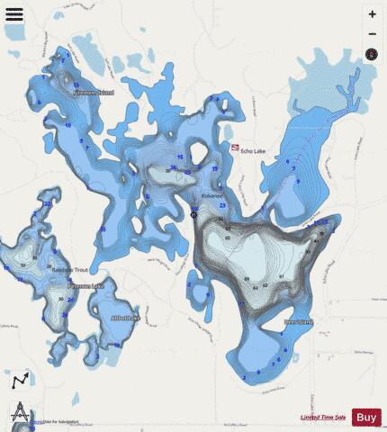
With our Lake Maps App, you get all the great marine chart app features like fishing spots, along with Echo Lake depth map. The fishing maps app include HD lake depth contours, along with advanced features found in Fish Finder / Gps Chart Plotter systems, turning your device into a Depth Finder. The Echo Lake Navigation App provides advanced features of a Marine Chartplotter including adjusting water level offset and custom depth shading. Fishing spots and depth contours layers are available in most Lake maps. Lake navigation features include advanced instrumentation to gather wind speed direction, water temperature, water depth, and accurate GPS with AIS receivers(using NMEA over TCP/UDP). Autopilot support can be enabled during ‘Goto WayPoint’ and ‘Route Assistance’.
Now i-Boating supports Fishing Points in Echo Lake.
Have more questions about the Nautical Chart App? Ask us.
Fishing Info for Echo Lake
Echo Lake is a small lake in the Flathead Valley in the U.S. state of Montana. It is located five miles from Bigfork and 25 miles from Kalispell. The lake is filled with groundwater and a small amount of mountain runoff from Echo Creek, making it one of the warmest lakes in the Flathead Valley. The lake is next to the Swan Range and the Jewel Basin hiking area. Echo Lake also is connected to two smaller lakes, Abbot Lake and Peterson Lake, by a canal. Echo Lake is popular among motorboaters because of its warm water. It is very common to see boats and personal watercraft in the summer. The lake is also popular among anglers due to its many coves and large numbers of fish, such as perch, pumpkinseed, largemouth bass, and northern pike. Much of the lake is surrounded by private lakefront property, including residences.
More on Wikipedia...Popular fish species in this lake include Largemouth bass, Northern pike and Pumpkinseed.
Echo Lake Fishing Map Stats | |
| Title | Echo Lake |
| Scale | 1:12000 |
| Counties | Flathead |
| Nearby Cities | Bigfork, Holt, Creston, Woods Bay, Somers, Bear Dance, Lakeside, Evergreen, Hungry Horse, Martin City |
| Area * | 716.26 acres |
| Shoreline * | 16.86 miles |
| Min Longitude | -114.06 |
| Min Latitude | 48.11 |
| Max Longitude | -114.02 |
| Max Latitude | 48.14 |
| Edition Label 1 | |
| Edition Label 2 | |
| Edition Label 3 | |
| Id | US_MT_mtfwp_1140423481273_mt |
| Country | US |
| Projection | Mercator |
| * some Stats may include nearby/connecting waterbodies | |
|