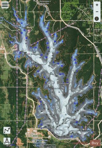
Stanley Draper Lake fishing map is available as part of iBoating : USA Marine & Fishing App(now supported on multiple platforms including Android, iPhone/iPad, MacBook, and Windows(tablet and phone)/PC based chartplotter.).
With our Lake Maps App, you get all the great marine chart app features like fishing spots, along with Stanley Draper Lake depth map. The fishing maps app include HD lake depth contours, along with advanced features found in Fish Finder / Gps Chart Plotter systems, turning your device into a Depth Finder. The Stanley Draper Lake Navigation App provides advanced features of a Marine Chartplotter including adjusting water level offset and custom depth shading. Fishing spots and depth contours layers are available in most Lake maps. Lake navigation features include advanced instrumentation to gather wind speed direction, water temperature, water depth, and accurate GPS with AIS receivers(using NMEA over TCP/UDP). Autopilot support can be enabled during ‘Goto WayPoint’ and ‘Route Assistance’.
Now i-Boating supports Fishing Points in Stanley Draper Lake.
Have more questions about the Nautical Chart App? Ask us.
Fishing Info for Stanley Draper Lake
Lake Stanley Draper is a reservoir in southeast Oklahoma City, United States. It is one of three municipal reservoirs in the city. It was constructed in 1962-1963, and named for the long-time director of the Oklahoma City Chamber of Commerce. Located between Midwest Boulevard and Post Road, near I-240, it receives water by pipeline from Atoka Lake and McGee Creek Reservoir.
More on Wikipedia...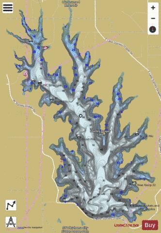
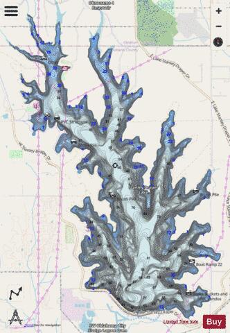
Stanley Draper Lake Fishing Map Stats | |
| Title | Stanley Draper Lake |
| Scale | 1:24000 |
| Counties | Cleveland, Oklahoma |
| Nearby Cities | Midwest City, Del City, Hall Park, Nicoma Park, Smith Village, Valley Brook, Moore, Choctaw, Norman, Spencer |
| Area * | 2560.47 acres |
| Shoreline * | 32.09 miles |
| Min Longitude | -97.38 |
| Min Latitude | 35.33 |
| Max Longitude | -97.33 |
| Max Latitude | 35.38 |
| Edition Label 1 | |
| Edition Label 2 | |
| Edition Label 3 | |
| Id | US_OK_stanleydraper |
| Country | US |
| Projection | Mercator |
| * some Stats may include nearby/connecting waterbodies | |
|