CedarCreek fishing map is available as part of iBoating : USA Marine & Fishing App(now supported on multiple platforms including Android, iPhone/iPad, MacBook, and Windows(tablet and phone)/PC based chartplotter.).
With our Lake Maps App, you get all the great marine chart app features like fishing spots, along with CedarCreek lake depth map. The fishing maps app include HD lake depth contours, along with advanced features found in Fish Finder / Gps Chart Plotter systems, turning your device into a Depth Finder. The CedarCreek Navigation App provides advanced features of a Marine Chartplotter including adjusting water level offset and custom depth shading. Fishing spots and depth contours layers are available in most Lake maps. Lake navigation features include advanced instrumentation to gather wind speed direction, water temperature, water depth, and accurate GPS with AIS receivers(using NMEA over TCP/UDP). Autopilot support can be enabled during ‘Goto WayPoint’ and ‘Route Assistance’.
Now i-Boating supports Fishing Points in CedarCreek.
Have more questions about the Nautical Chart App? Ask us.
Fishing Info for CedarCreek
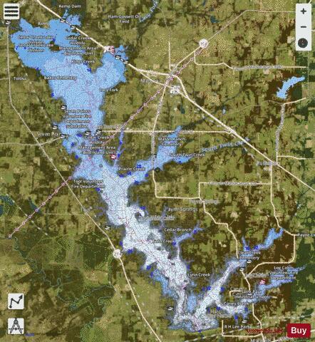
Cedar Creek Reservoir is a reservoir located in Henderson and Kaufman Counties, Texas (USA), 50 miles (80.5 km) southeast of Dallas. It is built on Cedar Creek, which flows into the Trinity River. Floodwaters are discharged through a gated spillway into a discharge channel that connects to the Trinity River.
More on Wikipedia...Popular fish species in this lake include Crappie, Largemouth bass and White bass.
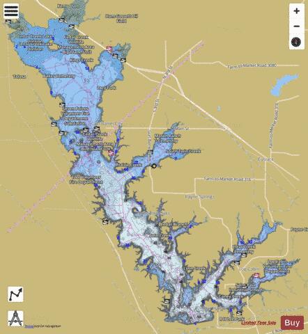
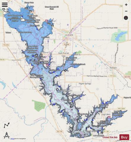
CedarCreek Fishing Map Stats | |
| Title | CedarCreek |
| Scale | 1:24000 |
| Counties | Henderson, Kaufman |
| Nearby Cities | Star Harbor, Caney City, Enchanted Oaks, Gun Barrel City, Log Cabin, Tool, Payne Springs, Seven Points, Malakoff, Kemp |
| Area * | 32875.56 acres |
| Shoreline * | 279.47 miles |
| Min Longitude | -96.24 |
| Min Latitude | 32.18 |
| Max Longitude | -95.98 |
| Max Latitude | 32.42 |
| Edition Label 1 | |
| Edition Label 2 | |
| Edition Label 3 | |
| Id | US_TX_cedarcreek |
| Country | US |
| Projection | Mercator |
| * some Stats may include nearby/connecting waterbodies | |
|