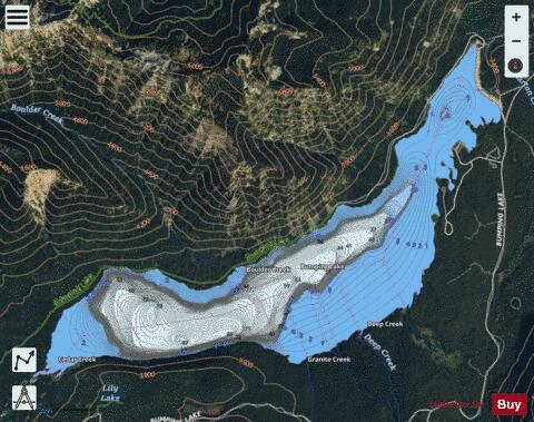
Bumping Lake fishing map is available as part of iBoating : USA Marine & Fishing App(now supported on multiple platforms including Android, iPhone/iPad, MacBook, and Windows(tablet and phone)/PC based chartplotter.).
With our Lake Maps App, you get all the great marine chart app features like fishing spots, along with Bumping Lake depth map. The fishing maps app include HD lake depth contours, along with advanced features found in Fish Finder / Gps Chart Plotter systems, turning your device into a Depth Finder. The Bumping Lake Navigation App provides advanced features of a Marine Chartplotter including adjusting water level offset and custom depth shading. Fishing spots and depth contours layers are available in most Lake maps. Lake navigation features include advanced instrumentation to gather wind speed direction, water temperature, water depth, and accurate GPS with AIS receivers(using NMEA over TCP/UDP). Autopilot support can be enabled during ‘Goto WayPoint’ and ‘Route Assistance’.
Now i-Boating supports Fishing Points in Bumping Lake.
Have more questions about the Nautical Chart App? Ask us.
Fishing Info for Bumping Lake
Bumping Lake is a lake and reservoir along the course of the Bumping River, in Yakima County, Washington state, USA. Bumping Lake has also named as "Lake Plehnam" by Preston's Map of Oregon and Washington in the 1850s, and "Tannum Lake" by the United States General Land Office Map of Washington of 1897. The lake is used as a storage reservoir for the Yakima Project, an irrigation project run by the United States Bureau of Reclamation. Although a natural lake, Bumping Lake's capacity and discharge is controlled by Bumping Lake Dam, a 60-foot (18 m) high earthfill structure built in 1910 and modified in the 1990s. As a storage reservoir, Bumping Lake's active capacity is 33,700 acre-feet (41,600,000 m3).
More on Wikipedia...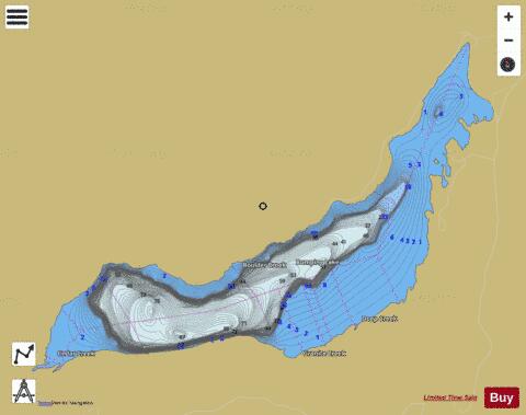
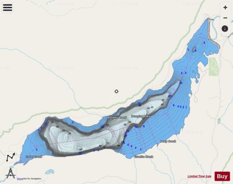
Bumping Lake Fishing Map Stats | |
| Title | Bumping Lake |
| Scale | 1:12000 |
| Counties | Yakima |
| Nearby Cities | Goose Prairie, Cliffdell, Nile, Packwood, Easton, Lester, Greenwater, Longmire, Ronald, Roslyn |
| Area * | 1353.73 acres |
| Shoreline * | 11.91 miles |
| Min Longitude | -121.37 |
| Min Latitude | 46.84 |
| Max Longitude | -121.30 |
| Max Latitude | 46.87 |
| Edition Label 1 | |
| Edition Label 2 | |
| Edition Label 3 | |
| Id | US_WA_01517091 |
| Country | US |
| Projection | Mercator |
| * some Stats may include nearby/connecting waterbodies | |
|