Lillooet Lake fishing map is included in Lakes and Rivers of British Columbia nautical charts folio. It is available as part of iBoating : Canada Marine & Fishing App (now supported on multiple platforms including Android, iPhone/iPad, MacBook, and Windows(tablet and phone)/PC based chartplotter. ).
With our Lake Maps App, you get all the great marine chart app features like fishing spots, along with Lillooet Lake depth map. The fishing maps app include HD lake depth contours, along with advanced features found in Fish Finder / Gps Chart Plotter systems, turning your device into a Depth Finder. The Lillooet Lake Navigation App provides advanced features of a Marine Chartplotter including adjusting water level offset and custom depth shading. Fishing spots and depth contours layers are available in most Lake maps. Lake navigation features include advanced instrumentation to gather wind speed direction, water temperature, water depth, and accurate GPS with AIS receivers(using NMEA over TCP/UDP). Autopilot support can be enabled during ‘Goto WayPoint’ and ‘Route Assistance’.
Now i-Boating supports Fishing Points in Lillooet Lake.
Have more questions about the Nautical Chart App? Ask us.
Fishing Info for Lillooet Lake
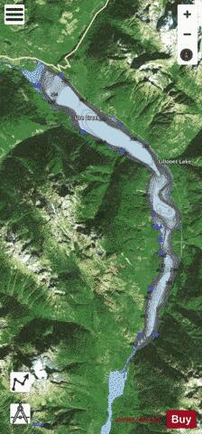
Lillooet Lake is a lake in British Columbia, Canada about 25 km in length and about 33.5 square kilometres (22 mi²) in area. It is about 95 km downstream from the source of the Lillooet River, which resumes its course after leaving Little Lillooet Lake, aka Tenas Lake (tenass in the Chinook Jargon means little). Immediately adjacent to the mouth of the upper Lillooet River is the mouth of the Birkenhead River and just upstream along the Lillooet is the confluence of the Green River, which begins at Green Lake in the resort area of Whistler. The community of Pemberton is about 12 km upstream from the head of Lillooet Lake, while the eastern edge of the Mount Currie Indian Reserve of the Lil'wat branch of the St'at'imc people is the lakeshore itself. The eastern ramparts of the mountain ranges of Garibaldi Provincial Park overlook Lillooet Lake from the west, while to the east are the northern reaches of the Lillooet Ranges which lie between the Lillooet-Harrison drainage and the Fraser River. Lillooet Lake was part of the "Lakes Route" or Douglas Road, once if only briefly the principal route between the Coast and the Interior during the days of the Fraser Canyon Gold Rush. Several steamers and innumerable smaller watercraft served the busy freight and passenger traffic in those days. The best-known and largest of these was the SS Prince of Wales, whose wreckage was visible on the shores of the lake near Mount Currie for many years.
More on Wikipedia...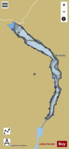
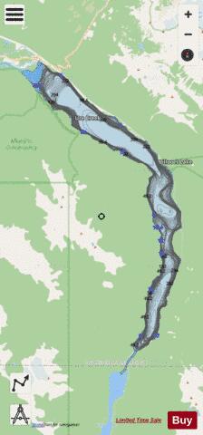
Lillooet Lake Fishing Map Stats | |
| Title | Lillooet Lake |
| Scale | 1:24000 |
| Districts | Fraser Valley, Squamish-Lillooet |
| Nearby Cities | Pemberton, Whistler, Lillooet, Squamish, Lions Bay, Mission |
| Area * | 8007.90 acres |
| Shoreline * | 37.36 miles |
| Min Longitude | -122.62 |
| Min Latitude | 50.12 |
| Max Longitude | -122.47 |
| Max Latitude | 50.31 |
| Edition Label 1 | |
| Edition Label 2 | |
| Edition Label 3 | |
| Id | CA_BC_lillooet_lake_bc |
| Country | CA |
| Projection | Mercator |
| * some Stats may include nearby/connecting waterbodies | |
| |||||||||||||||||||||||||||||||||||||||||||||||||||||||||||||||||||||||||||||||||||||||||||||||||||||||
|