Lac Baker fishing map is included in New Brunswick Fishing Maps nautical charts folio. It is available as part of iBoating : Canada Marine & Fishing App (now supported on multiple platforms including Android, iPhone/iPad, MacBook, and Windows(tablet and phone)/PC based chartplotter. ).
With our Lake Maps App, you get all the great marine chart app features like fishing spots, along with Lac Baker depth map. The fishing maps app include HD lake depth contours, along with advanced features found in Fish Finder / Gps Chart Plotter systems, turning your device into a Depth Finder. The Lac Baker Navigation App provides advanced features of a Marine Chartplotter including adjusting water level offset and custom depth shading. Fishing spots and depth contours layers are available in most Lake maps. Lake navigation features include advanced instrumentation to gather wind speed direction, water temperature, water depth, and accurate GPS with AIS receivers(using NMEA over TCP/UDP). Autopilot support can be enabled during ‘Goto WayPoint’ and ‘Route Assistance’.
Now i-Boating supports Fishing Points in Lac Baker.
Have more questions about the Nautical Chart App? Ask us.
Fishing Info for Lac Baker
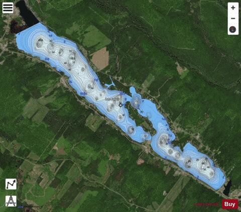
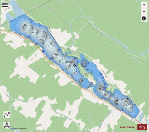
Lac Baker (meaning "Lake Baker") is a Canadian lake with an area of 6 km2 located in northwestern New Brunswick on the border with Quebec. The lake drains to the south through Baker Brook into the Saint John River at the community of Baker Brook. The northern part of the lake stretches 0.8 kilometres (0.50 mi) to the northwest, in the municipality of in Quebec province. This lake has a central island with a length of 1.2 kilometres (0.75 mi) and a maximum width of 0.3 kilometres (0.19 mi), counting about fifty chalets. This lake is supplied in term of water from Kitchen Creek (from the West, i.e. from the Quebec). The mouth of the lake is located on the provincial border in the northwest part of the lake. The lake is surrounded by a road for cottages arranged around it.
More on Wikipedia...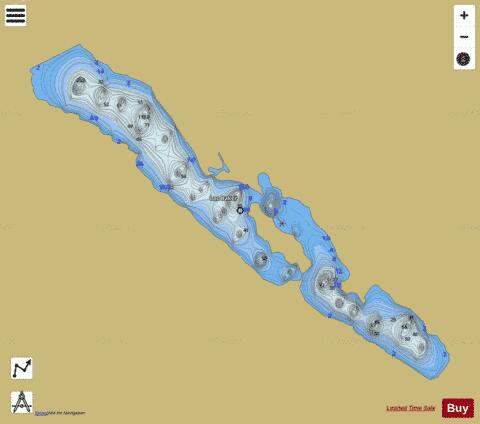
Lac Baker Fishing Map Stats | |
| Title | Lac Baker |
| Scale | 1:12000 |
| Nearby Cities | Dégelis, Notre-Dame-du-Lac, Edmundston, Cabano, St. Leonard, Trois-Pistoles, Rivière-du-Loup, Saint-Fabien, Grand Falls / Grand-Sault, Saint-Alexandre |
| Area * | 1351.02 acres |
| Shoreline * | 14.76 miles |
| Min Longitude | -68.72 |
| Min Latitude | 47.34 |
| Max Longitude | -68.64 |
| Max Latitude | 47.38 |
| Edition Label 1 | |
| Edition Label 2 | |
| Edition Label 3 | |
| Id | CA_NB_baker_nb |
| Country | CA |
| Projection | Mercator |
| * some Stats may include nearby/connecting waterbodies | |
| |||||||||||||||||||||||||||||||||||||||||||||||||||||||||||||||||||||||||||||||||||||||||||||||||||||||
|