Talbot Lake fishing map is included in Ontario Lakes nautical charts folio. It is available as part of iBoating : Canada Marine & Fishing App (now supported on multiple platforms including Android, iPhone/iPad, MacBook, and Windows(tablet and phone)/PC based chartplotter. ).
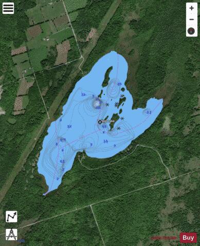
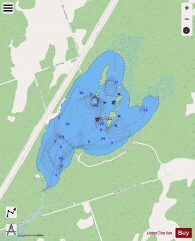
With our Lake Maps App, you get all the great marine chart app features like fishing spots, along with Talbot Lake depth map. The fishing maps app include HD lake depth contours, along with advanced features found in Fish Finder / Gps Chart Plotter systems, turning your device into a Depth Finder. The Talbot Lake Navigation App provides advanced features of a Marine Chartplotter including adjusting water level offset and custom depth shading. Fishing spots and depth contours layers are available in most Lake maps. Lake navigation features include advanced instrumentation to gather wind speed direction, water temperature, water depth, and accurate GPS with AIS receivers(using NMEA over TCP/UDP). Autopilot support can be enabled during ‘Goto WayPoint’ and ‘Route Assistance’.
Now i-Boating supports Fishing Points in Talbot Lake.
Have more questions about the Nautical Chart App? Ask us.
Fishing Info for Talbot Lake
The Talbot River is a river in the Great Lakes Basin in Central Ontario, Canada which flows from to Lake Simcoe and forms the border between Ramara township to the north and the Brock township to the south from the river mouth to the edge of their border with the city of Kawartha Lakes at the east. The lower section of the river is now part of the Trent-Severn Waterway, although a new more direct channel was cut at the end of the 19th century, bypassing the original mouth of the river. The Talbot River drains the natural and Talbot Lakes, as well as the man-made Mitchell and Canal Lakes. Even before the construction of the waterway, the river provided an important transportation corridor for native peoples and early settlers.
More on Wikipedia...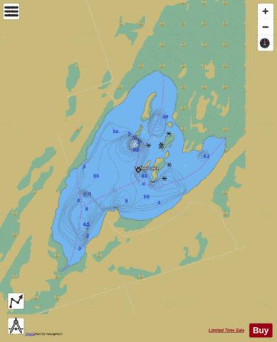
Talbot Lake Fishing Map Stats | |
| Title | Talbot Lake |
| Scale | 1:12000 |
| Districts | Kawartha Lakes |
| Nearby Cities | Fenelon Falls, Bobcaygeon, Lindsay, Cannington, Beaverton, Sunderland, Omemee, Haliburton Village, Amigo Beach, Bridgenorth - Chemong Park Area |
| Area * | 342.37 acres |
| Shoreline * | 5.90 miles |
| Min Longitude | -78.86 |
| Min Latitude | 44.69 |
| Max Longitude | -78.84 |
| Max Latitude | 44.71 |
| Edition Label 1 | |
| Edition Label 2 | |
| Edition Label 3 | |
| Id | CA_ON_R_103380745 |
| Country | CA |
| Projection | Mercator |
| * some Stats may include nearby/connecting waterbodies | |
|