Meech Lac fishing map is included in Quebec to Anticosti Island West nautical charts folio. It is available as part of iBoating : Canada Marine & Fishing App (now supported on multiple platforms including Android, iPhone/iPad, MacBook, and Windows(tablet and phone)/PC based chartplotter. ).
With our Lake Maps App, you get all the great marine chart app features like fishing spots, along with Meech Lac depth map. The fishing maps app include HD lake depth contours, along with advanced features found in Fish Finder / Gps Chart Plotter systems, turning your device into a Depth Finder. The Meech Lac Navigation App provides advanced features of a Marine Chartplotter including adjusting water level offset and custom depth shading. Fishing spots and depth contours layers are available in most Lake maps. Lake navigation features include advanced instrumentation to gather wind speed direction, water temperature, water depth, and accurate GPS with AIS receivers(using NMEA over TCP/UDP). Autopilot support can be enabled during ‘Goto WayPoint’ and ‘Route Assistance’.
Now i-Boating supports Fishing Points in Meech Lac.
Have more questions about the Nautical Chart App? Ask us.
Fishing Info for Meech Lac
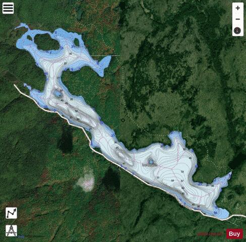
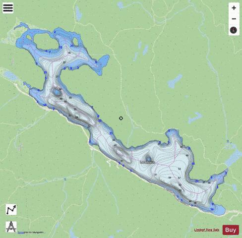
Meech Lake (French: Lac Meech) is located within Gatineau Park in the Municipality of Chelsea, Quebec, Canada. It is located about 20 km northwest of Gatineau. The lake was named after Reverend Asa Meech, an early settler in the area. Near the lake, on Meech Creek, are the ruins of a fertilizer plant built by Thomas "Carbide" Willson during the 1900s. In 1981, Willson's former summer home (the Willson House) on Meech Lake was converted into a government conference centre. The house is notable for its use, in 1987, as the site of meetings on the Meech Lake Accord (which proposed the overhauling of Canada's constitution) between the provincial premiers and then-Prime Minister Brian Mulroney. The lake is a multi-use area with picnicking, beach goers, boats, paddle boards, and historic cottages dating to before the park was formed. It is a popular lake for people who like to train in open water swimming. It is also the site of the annual Meech Lake Triathlon. In 1988, a study conducted for the NCC confirmed that Meech Lake residents are responsible for most of the human-produced phosphorus flowing into the lake, i.e., 66%, whereas visitors only account for 26%. Phosphorus, in excessive amounts is responsible for the proliferation of blue-green algae, a problem that has afflicted the lake in recent years. The National Capital Commission (NCC), steward of Gatineau Park, operates beaches on the lake during the summer. Although it is not condoned by the NCC, there is a secluded beach often used by naturists. Lack of clear signage on the lake that fires are prohibited as well as enforcement is one problem of this highly used area. For example, in the summer of 2016 a fire on one island caused by a picnicker resulted in 25% of the island burning.
More on Wikipedia...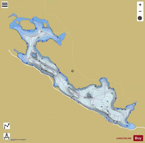
Meech Lac Fishing Map Stats | |
| Title | Meech Lac |
| Scale | 1:12000 |
| Districts | Les Collines-de-l'Outaouais |
| Nearby Cities | Constance Bay, Ottawa - Gatineau, Kanata, Ottawa - Gatineau, Richmond, Angers, Manotick Station, Almonte, Buckingham, Arnprior |
| Area * | 713.81 acres |
| Shoreline * | 12.33 miles |
| Min Longitude | -75.92 |
| Min Latitude | 45.53 |
| Max Longitude | -75.87 |
| Max Latitude | 45.56 |
| Edition Label 1 | |
| Edition Label 2 | |
| Edition Label 3 | |
| Id | CA_QC_Meech_Lac__qc |
| Country | CA |
| Projection | Mercator |
| * some Stats may include nearby/connecting waterbodies | |
|