Upper Fishing Lake fishing map is included in Saskatchewan Fishing Maps nautical charts folio. It is available as part of iBoating : Canada Marine & Fishing App (now supported on multiple platforms including Android, iPhone/iPad, MacBook, and Windows(tablet and phone)/PC based chartplotter. ).
With our Lake Maps App, you get all the great marine chart app features like fishing spots, along with Upper Fishing Lake depth map. The fishing maps app include HD lake depth contours, along with advanced features found in Fish Finder / Gps Chart Plotter systems, turning your device into a Depth Finder. The Upper Fishing Lake Navigation App provides advanced features of a Marine Chartplotter including adjusting water level offset and custom depth shading. Fishing spots and depth contours layers are available in most Lake maps. Lake navigation features include advanced instrumentation to gather wind speed direction, water temperature, water depth, and accurate GPS with AIS receivers(using NMEA over TCP/UDP). Autopilot support can be enabled during ‘Goto WayPoint’ and ‘Route Assistance’.
Now i-Boating supports Fishing Points in Upper Fishing Lake.
Have more questions about the Nautical Chart App? Ask us.
Fishing Info for Upper Fishing Lake
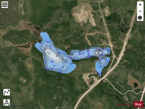
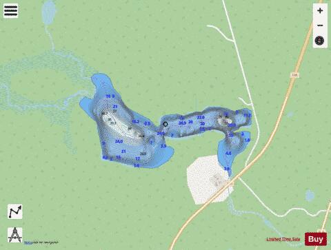
Upper Fishing Lake is a lake in the east-central part of the Canadian province of Saskatchewan in Narrow Hills Provincial Park. It is situated in a glacier-formed valley in the Cub Hills and the boreal forest ecozone of Canada. It is located north-west of the larger Lower Fishing Lake along the course of Caribou Creek and is accessed from the Hanson Lake Road. Caribou Creek, and the lake's other inflow, a river that flows south from Stickley Lake, flow into the lake at its north-western point. Caribou Creek flows out of the lake at its south-eastern point. The Fishing Lakes Fire of 1977 burned much of the region upstream and around the lake. As a result, the area is now dominated by jack pine, which is a tree species that is well adapted fire burned forests. At the south-east corner of the lake, near where Caribou Creek flows out, is Caribou Creek Lodge. The lodge is accessed from Hanson Lake Road and features a motel, cabins, a dining room, fuel, and a convenience store.
More on Wikipedia...Popular fish species in this lake include Northern pike and Walleye.
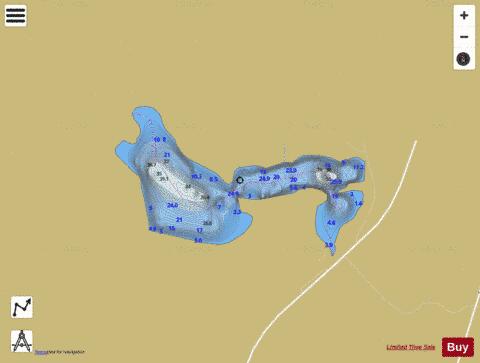
Upper Fishing Lake Fishing Map Stats | |
| Title | Upper Fishing Lake |
| Scale | 1:6000 |
| Nearby Cities | Nipawin |
| Area * | 126.02 acres |
| Shoreline * | 3.30 miles |
| Min Longitude | -104.67 |
| Min Latitude | 54.05 |
| Max Longitude | -104.65 |
| Max Latitude | 54.06 |
| Edition Label 1 | |
| Edition Label 2 | |
| Edition Label 3 | |
| Id | CA_SK_Upper_Fishing_Lake_sk |
| Country | CA |
| Projection | Mercator |
| * some Stats may include nearby/connecting waterbodies | |
|