York Lake fishing map is included in Saskatchewan Fishing Maps nautical charts folio. It is available as part of iBoating : Canada Marine & Fishing App (now supported on multiple platforms including Android, iPhone/iPad, MacBook, and Windows(tablet and phone)/PC based chartplotter. ).
With our Lake Maps App, you get all the great marine chart app features like fishing spots, along with York Lake depth map. The fishing maps app include HD lake depth contours, along with advanced features found in Fish Finder / Gps Chart Plotter systems, turning your device into a Depth Finder. The York Lake Navigation App provides advanced features of a Marine Chartplotter including adjusting water level offset and custom depth shading. Fishing spots and depth contours layers are available in most Lake maps. Lake navigation features include advanced instrumentation to gather wind speed direction, water temperature, water depth, and accurate GPS with AIS receivers(using NMEA over TCP/UDP). Autopilot support can be enabled during ‘Goto WayPoint’ and ‘Route Assistance’.
Now i-Boating supports Fishing Points in York Lake.
Have more questions about the Nautical Chart App? Ask us.
Fishing Info for York Lake
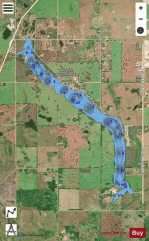
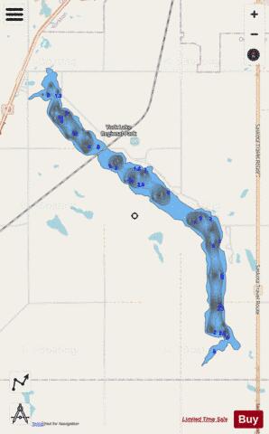
York Lake, formally known as Pebble Lake, is a lake in the south-east region of the Canadian province of Saskatchewan. It is a shallow, narrow lake located about 5 km (3.1 mi) south of the city of Yorkton in the Prairie Pothole Region of North America, which extends throughout three Canadian provinces and five U.S. states, and within Palliser's Triangle and the Great Plains ecoregion of Canada. The primary inflow for York Lake is from Willow Brook, which begins in the RM of Garry No. 245 in the Beaver Hills. Willow Brook travels in an easterly direction from the hills into Rousay Lake, which is connected to York Lake at its northern end. At the southern end of York Lake, the lake's outflow leaves the lake and heads in a north-east to Yorkton Creek, south of Yorkton. York Lake Golf & Country Club is at the northern end of the lake and Yorkton Lake Regional Park and Maple Gove Estates are on the eastern shore.
More on Wikipedia...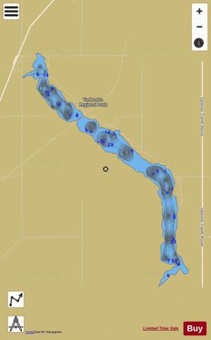
York Lake Fishing Map Stats | |
| Title | York Lake |
| Scale | 1:12000 |
| Nearby Cities | Yorkton, Melville, Canora, Esterhazy, Kamsack |
| Area * | 780.02 acres |
| Shoreline * | 12.79 miles |
| Min Longitude | -102.52 |
| Min Latitude | 51.12 |
| Max Longitude | -102.46 |
| Max Latitude | 51.18 |
| Edition Label 1 | |
| Edition Label 2 | |
| Edition Label 3 | |
| Id | CA_SK_york_lake__sk |
| Country | CA |
| Projection | Mercator |
| * some Stats may include nearby/connecting waterbodies | |
|