Kusawa fishing map is included in Yukon Fishing Maps nautical charts folio. It is available as part of iBoating : Canada Marine & Fishing App (now supported on multiple platforms including Android, iPhone/iPad, MacBook, and Windows(tablet and phone)/PC based chartplotter. ).
With our Lake Maps App, you get all the great marine chart app features like fishing spots, along with Kusawa lake depth map. The fishing maps app include HD lake depth contours, along with advanced features found in Fish Finder / Gps Chart Plotter systems, turning your device into a Depth Finder. The Kusawa Navigation App provides advanced features of a Marine Chartplotter including adjusting water level offset and custom depth shading. Fishing spots and depth contours layers are available in most Lake maps. Lake navigation features include advanced instrumentation to gather wind speed direction, water temperature, water depth, and accurate GPS with AIS receivers(using NMEA over TCP/UDP). Autopilot support can be enabled during ‘Goto WayPoint’ and ‘Route Assistance’.
Now i-Boating supports Fishing Points in Kusawa.
Have more questions about the Nautical Chart App? Ask us.
Fishing Info for Kusawa
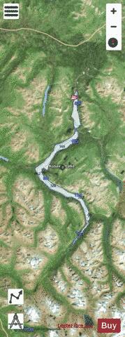
Kusawa Lake is a lake in the southern Yukon, Canada. Kusawa means "long narrow lake" in the Tlingit language. The Kusawa Lake is a lake in Canada's Yukon Territory. It is located at an altitude of 671 m (2,201 ft) and is 60 km (37 mi) southwest of Whitehorse near the British Columbia border. It meanders over a length of 75 km (47 mi) with a maximum width of about 2.5 km (1.6 mi) through the mountains in the north of the Boundary Ranges. It is fed by the and . The Takhini outflows to the Yukon River from the northern tip of Kusawa Lake. Kusawa Lake has an area of 142 km2 (55 sq mi). The lake has a maximum depth of 140 m (460 ft) and is of glacial origin. It is a common tourist destination and is also popular for fishing.
More on Wikipedia...Popular fish species in this lake include Arctic grayling and Herring.
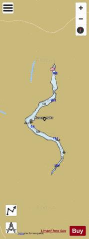
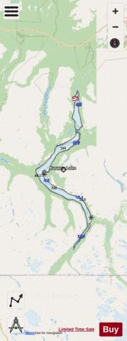
Kusawa Fishing Map Stats | |
| Title | Kusawa |
| Scale | 1:24000 |
| Area * | 34641.22 acres |
| Shoreline * | 111.81 miles |
| Min Longitude | -136.41 |
| Min Latitude | 60.08 |
| Max Longitude | -136.03 |
| Max Latitude | 60.61 |
| Edition Label 1 | |
| Edition Label 2 | |
| Edition Label 3 | |
| Id | CA_YT_kusawa |
| Country | CA |
| Projection | Mercator |
| * some Stats may include nearby/connecting waterbodies | |
|