Vangsvatnet fishing map is included in Østfold nautical charts folio. It is available as part of iBoating : Norway Marine & Fishing App (now supported on multiple platforms including Android, iPhone/iPad, MacBook, and Windows(tablet and phone)/PC based chartplotter. ).
With our Lake Maps App, you get all the great marine chart app features like fishing spots, along with Vangsvatnet lake depth map. The fishing maps app include HD lake depth contours, along with advanced features found in Fish Finder / Gps Chart Plotter systems, turning your device into a Depth Finder. The Vangsvatnet Navigation App provides advanced features of a Marine Chartplotter including adjusting water level offset and custom depth shading. Fishing spots and depth contours layers are available in most Lake maps. Lake navigation features include advanced instrumentation to gather wind speed direction, water temperature, water depth, and accurate GPS with AIS receivers(using NMEA over TCP/UDP). Autopilot support can be enabled during ‘Goto WayPoint’ and ‘Route Assistance’.
Have more questions about the Nautical Chart App? Ask us.
Fishing Info for Vangsvatnet
Vangsvatnet is a lake in the municipality of Voss in Vestland county, Norway. The 7.69-square-kilometre (2.97 sq mi) lake lies in the central part of the municipality, on the southwestern shore of the municipal centre of Vossevangen. The Vosso River flows through both Vangsvatnet and the lake Evangervatnet before it empties into Bolstadfjorden by the village of Bolstadøyri to the west. The lake is used for various water-based extreme sports activities like Kite surfing and boat dragged paragliding. Other activities include paddleboarding, windsurfing and canoeing with . Vangsvatnet is named after the place Vangen—the municipal center and old churchsite of Voss. The last element is the finite form of vatn, meaning lake. European route E16 and the Bergen Line both run along the northern shore of the lake.
More on Wikipedia...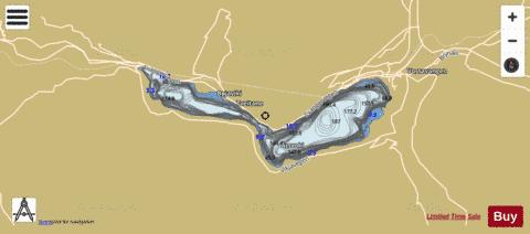
Vangsvatnet Fishing Map Stats | |
| Title | Vangsvatnet |
| Scale | 1:24000 |
| Min Longitude | 6.28 |
| Min Latitude | 60.60 |
| Max Longitude | 6.42 |
| Max Latitude | 60.63 |
| Edition Label 1 | |
| Edition Label 2 | |
| Edition Label 3 | |
| Id | NO_LK_2085 |
| Country | Norway |
| Projection | Mercator |
| * some Stats may include nearby/connecting waterbodies | |
|