Eikeren fishing map is included in √ėstfold nautical charts folio. It is available as part of iBoating : Norway Marine & Fishing App (now supported on multiple platforms including Android, iPhone/iPad, MacBook, and Windows(tablet and phone)/PC based chartplotter. ).
With our Lake Maps App, you get all the great marine chart app features like fishing spots, along with Eikeren lake depth map. The fishing maps app include HD lake depth contours, along with advanced features found in Fish Finder / Gps Chart Plotter systems, turning your device into a Depth Finder. The Eikeren Navigation App provides advanced features of a Marine Chartplotter including adjusting water level offset and custom depth shading. Fishing spots and depth contours layers are available in most Lake maps. Lake navigation features include advanced instrumentation to gather wind speed direction, water temperature, water depth, and accurate GPS with AIS receivers(using NMEA over TCP/UDP). Autopilot support can be enabled during ‚ÄėGoto WayPoint‚Äô and ‚ÄėRoute Assistance‚Äô.
Have more questions about the Nautical Chart App? Ask us.
Fishing Info for Eikeren
Eikeren or Eikern is a long and deep lake in the municipalities of Hof in the county of Vestfold og Telemark and √ėvre Eiker in the county of Viken, Norway. It is the largest lake in Vestfold. At the eastern end of Vestfold is the village of Eidsfoss. In this area, water flows into Lake Eikeren from the Bergsvann, Vikevann, Haugestadvann and Hillestadvann. Lake Eikeren also receives waterflow from the and Rivers. In the western part, Eikeren comes together with the in a narrow, strait known as Sundet. Here water flows into Lake Fiskum, located at the top of Eikernvassdraget. Through this strait, water flows at an average of 7 m3 per second. From Lake Fiskum, water runs out into to Vestfossen. The river then go to Hokksund, where it splits into two river that both flow in the Drammen River. Eikeren, together with Fiskumvannet, is 20 km long, up to 2,5 km wide and up to 158 m deep. In 2005, Lake Eikeren was developed by the Vestfold Inter Municipal Waterworks, (Vestfold Interkommunale Vannverk), in order to provide extra drinking water for Vestfold. The other source is Farrisvannet, a lake on the border between the former counties of Vestfold and Telemark (now united). Vestfold Inter Municipal Waterworks Authority is a company owned by ten municipalities in Vestfold and is responsible for water supply, water treatment, emergency power supply and the main distribution to its members. During the summer season, Lake Eikeren is served by tourist boat M/S Eikern between Eidsfoss and Vestfossen. The original M/S Eikern steamer was commissioned in 1861. The steam vessel Cappelen was built in 1880 and was used for timber and passenger traffic. In 1903, the steamship Stadshauptmand Schwartz carried regular traffic and provided a link between the Kongsberg Railway (Kongsbergbanen) and the T√łnsberg‚ÄďEidsfoss Line. The current vessel M/S Eikern has carried traffic on Lake Eikern since 1997.
More on Wikipedia...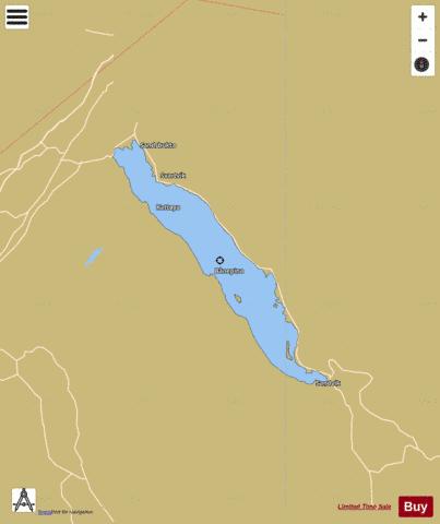
Eikeren Fishing Map Stats | |
| Title | Eikeren |
| Scale | 1:24000 |
| Min Longitude | 9.84 |
| Min Latitude | 59.59 |
| Max Longitude | 10.04 |
| Max Latitude | 59.70 |
| Edition Label 1 | |
| Edition Label 2 | |
| Edition Label 3 | |
| Id | NO_LK_542 |
| Country | Norway |
| Projection | Mercator |
| * some Stats may include nearby/connecting waterbodies | |
| |||||||||||||||||||||||||||||||||||||||||||||||||||||||||||||||||||||||||||||||||||||||||||||||||||||||
|