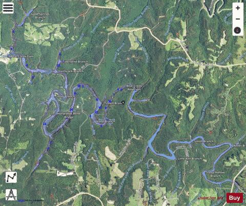
Bear Creek Reservoir fishing map is available as part of iBoating : USA Marine & Fishing App(now supported on multiple platforms including Android, iPhone/iPad, MacBook, and Windows(tablet and phone)/PC based chartplotter.).
With our Lake Maps App, you get all the great marine chart app features like fishing spots, along with Bear Creek Reservoir depth map. The fishing maps app include HD lake depth contours, along with advanced features found in Fish Finder / Gps Chart Plotter systems, turning your device into a Depth Finder. The Bear Creek Reservoir Navigation App provides advanced features of a Marine Chartplotter including adjusting water level offset and custom depth shading. Fishing spots and depth contours layers are available in most Lake maps. Lake navigation features include advanced instrumentation to gather wind speed direction, water temperature, water depth, and accurate GPS with AIS receivers(using NMEA over TCP/UDP). Autopilot support can be enabled during ‘Goto WayPoint’ and ‘Route Assistance’.
Now i-Boating supports Fishing Points in Bear Creek Reservoir.
Have more questions about the Nautical Chart App? Ask us.
Fishing Info for Bear Creek Reservoir
The Bear Creek Reservoir is a reservoir located in Franklin County, Alabama, along Bear Creek. Bear Creek Dam is one of four Tennessee Valley Authority dams in the area, 68 feet (21 m) high, creating a maximum flood control capacity of 37,800 acre-feet (47 million cubic meters). No hydroelectric power is generated here.
More on Wikipedia...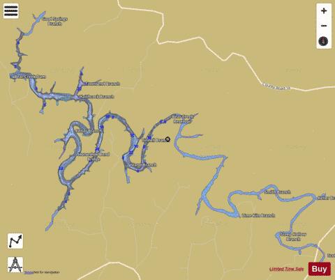
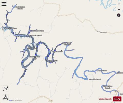
Bear Creek Reservoir Fishing Map Stats | |
| Title | Bear Creek Reservoir |
| Scale | 1:12000 |
| Counties | Franklin |
| Nearby Cities | Hodges, Vina, Hackleburg, Belgreen, Pleasant Site, Red Bay, Isbell, Spruce Pine, Phil Campbell, Weston |
| Area * | 653.54 acres |
| Shoreline * | 45.47 miles |
| Min Longitude | -87.99 |
| Min Latitude | 34.35 |
| Max Longitude | -87.90 |
| Max Latitude | 34.41 |
| Edition Label 1 | |
| Edition Label 2 | |
| Edition Label 3 | |
| Id | US_AA_AL_bearcreekreservoir_al |
| Country | US |
| Projection | Mercator |
| * some Stats may include nearby/connecting waterbodies | |
|