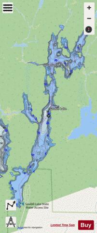
Sawbill Lake fishing map is available as part of iBoating : USA Marine & Fishing App(now supported on multiple platforms including Android, iPhone/iPad, MacBook, and Windows(tablet and phone)/PC based chartplotter.).
With our Lake Maps App, you get all the great marine chart app features like fishing spots, along with Sawbill Lake depth map. The fishing maps app include HD lake depth contours, along with advanced features found in Fish Finder / Gps Chart Plotter systems, turning your device into a Depth Finder. The Sawbill Lake Navigation App provides advanced features of a Marine Chartplotter including adjusting water level offset and custom depth shading. Fishing spots and depth contours layers are available in most Lake maps. Lake navigation features include advanced instrumentation to gather wind speed direction, water temperature, water depth, and accurate GPS with AIS receivers(using NMEA over TCP/UDP). Autopilot support can be enabled during ‘Goto WayPoint’ and ‘Route Assistance’.
Now i-Boating supports Fishing Points in Sawbill Lake.
Have more questions about the Nautical Chart App? Ask us.
Fishing Info for Sawbill Lake
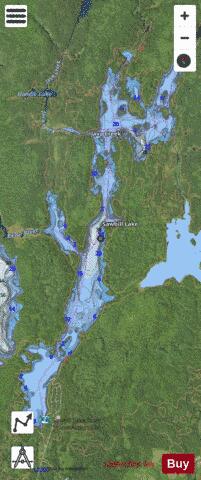
Sawbill Lake is a lake in Cook County, Minnesota. The closest town to Sawbill Lake is Tofte. It is a popular entry point (number 38) to the Boundary Waters Canoe Area Wilderness in the Superior National Forest. Sawbill is a nickname of the common merganser duck. There is a United States Forest Service cabin, a canoe outfitter, and a campground located at the southern end of the lake. During the Great Depression there was a Civilian Conservation Corps camp six miles south of the lake. Sawbill has portages connecting it to Smoke Lake, Kelso Lake, Ada Creek and .
More on Wikipedia...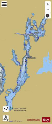
Sawbill Lake Fishing Map Stats | |
| Title | Sawbill Lake |
| Scale | 1:6000 |
| Counties | Cook |
| Nearby Cities | Tofte, Lutsen, Schroeder, Taconite Harbor, Forest Center, Little Marais, Isabella, Grand Marais, Murphy City, Finland |
| Area * | 834.04 acres |
| Shoreline * | 26.32 miles |
| Min Longitude | -90.89 |
| Min Latitude | 47.86 |
| Max Longitude | -90.86 |
| Max Latitude | 47.92 |
| Edition Label 1 | |
| Edition Label 2 | |
| Edition Label 3 | |
| Id | US_AA_MN_16049600_mn |
| Country | US |
| Projection | Mercator |
| * some Stats may include nearby/connecting waterbodies | |
|