Lake Wateree fishing map is available as part of iBoating : USA Marine & Fishing App(now supported on multiple platforms including Android, iPhone/iPad, MacBook, and Windows(tablet and phone)/PC based chartplotter.).
With our Lake Maps App, you get all the great marine chart app features like fishing spots, along with Lake Wateree depth map. The fishing maps app include HD lake depth contours, along with advanced features found in Fish Finder / Gps Chart Plotter systems, turning your device into a Depth Finder. The Lake Wateree Navigation App provides advanced features of a Marine Chartplotter including adjusting water level offset and custom depth shading. Fishing spots and depth contours layers are available in most Lake maps. Lake navigation features include advanced instrumentation to gather wind speed direction, water temperature, water depth, and accurate GPS with AIS receivers(using NMEA over TCP/UDP). Autopilot support can be enabled during ‘Goto WayPoint’ and ‘Route Assistance’.
Now i-Boating supports Fishing Points in Lake Wateree.
Have more questions about the Nautical Chart App? Ask us.
Fishing Info for Lake Wateree
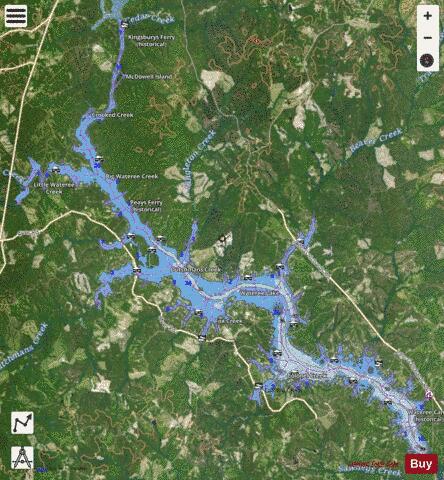
Lake Wateree is a 21-square-mile (50 km2) reservoir in Kershaw, Fairfield, and Lancaster counties, South Carolina, in the United States. Developed in 1919 by the damming of the Wateree River, it is one of South Carolina's oldest man-made lakes. It has 181 miles (291 km) of shoreline and includes Lake Wateree State Park, a bird refuge, and Shaw Air Force Base Recreation Center. It was named after the river, and both were named for the Wateree Native Americans, an historic tribe who lived in the area before European settlement. They became extinct as a tribe after European warfare and encroachment, and their descendants merged with the Catawba people.
More on Wikipedia...Popular fish species in this lake include Crappie, Redear sunfish, Striped bass and White bass.
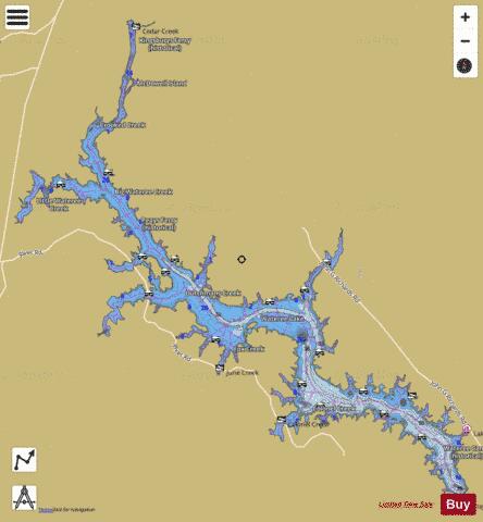
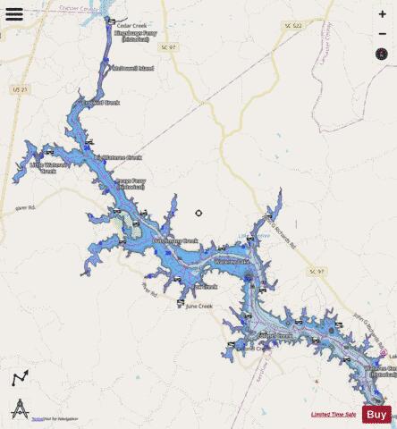
Lake Wateree Fishing Map Stats | |
| Title | Lake Wateree |
| Scale | 1:12000 |
| Counties | Fairfield, Kershaw, Lancaster |
| Nearby Cities | Great Falls, Liberty Hill, Lugoff, Ridgeway, Camden, Westville, Irwin, Fort Lawn, Winnsboro, Heath Springs |
| Area * | 11756.24 acres |
| Shoreline * | 173.18 miles |
| Min Longitude | -80.94 |
| Min Latitude | 34.33 |
| Max Longitude | -80.70 |
| Max Latitude | 34.54 |
| Edition Label 1 | |
| Edition Label 2 | |
| Edition Label 3 | |
| Id | US_AA_SC_lake_wateree_sc |
| Country | US |
| Projection | Mercator |
| * some Stats may include nearby/connecting waterbodies | |
|