Blanca Lake, Snohomish County fishing map is available as part of iBoating : USA Marine & Fishing App(now supported on multiple platforms including Android, iPhone/iPad, MacBook, and Windows(tablet and phone)/PC based chartplotter.).
With our Lake Maps App, you get all the great marine chart app features like fishing spots, along with Blanca Lake, Snohomish County depth map. The fishing maps app include HD lake depth contours, along with advanced features found in Fish Finder / Gps Chart Plotter systems, turning your device into a Depth Finder. The Blanca Lake, Snohomish County Navigation App provides advanced features of a Marine Chartplotter including adjusting water level offset and custom depth shading. Fishing spots and depth contours layers are available in most Lake maps. Lake navigation features include advanced instrumentation to gather wind speed direction, water temperature, water depth, and accurate GPS with AIS receivers(using NMEA over TCP/UDP). Autopilot support can be enabled during ‘Goto WayPoint’ and ‘Route Assistance’.
Now i-Boating supports Fishing Points in Blanca Lake, Snohomish County.
Have more questions about the Nautical Chart App? Ask us.
Fishing Info for Blanca Lake, Snohomish County
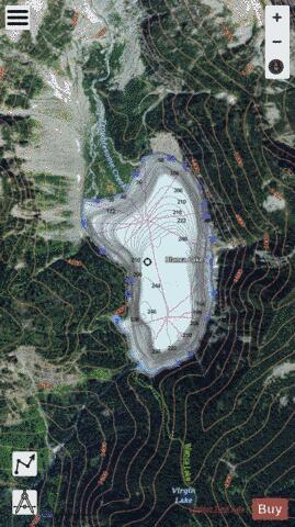
Blanca Lake is located in the Henry M. Jackson Wilderness Area in the Cascade Mountains of the U.S. state of Washington. Blanca Lake sits in a basin surrounded by the peaks of Monte Cristo, Kyes, and Columbia. The lake is fed by the Columbia Glacier to the northwest and is drained by Troublesome Creek, a tributary of the North Fork Skykomish River. The glacier's cold, silt-filled melt water is what makes the lake a spectacular turquoise green color making this a prime example of a rock flour lake. Blanca Lake is accessible only by foot, along the Blanca Lake Trail. The trail begins at 1,900 ft (579 m). The trail climbs quickly from switchback to switchback, gaining 2,700 ft (823 m) elevation over 3 mi (4.8 km), finally arriving at the top of a ridge. From the ridge-top, the trail continues through sub-alpine meadows until you reach Virgin Lake at 4,600 ft (1,402 m). From Virgin Lake, the trail gets rocky, and steeply descends 600 ft (183 m) over 0.5 mi (0.8 km) to Blanca Lake. Due to its elevation, and the heavy snowpack of the Pacific Northwest, Blanca Lake is typically only easily accessible from June until the snows of October or November. Its beauty makes it a very popular destination for hikers, despite the difficult climb up the mountain trail. To get to the trailhead, take US Forest Road 65/Beckler Road 13.7 mi (22.0 km) near Skykomish, WA to the intersection with US Forest Road 63. Northwest Forest Pass is still required to park and a US Forest Service Daily Fee of $5 per vehicle.
More on Wikipedia...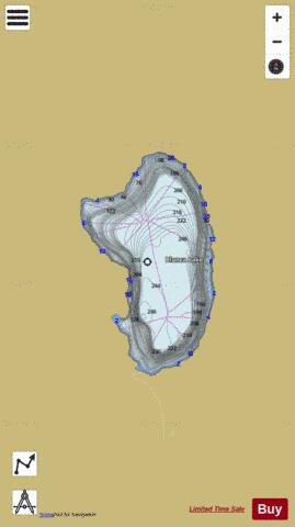
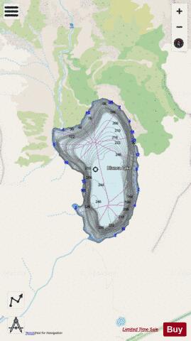
Blanca Lake, Snohomish County Fishing Map Stats | |
| Title | Blanca Lake, Snohomish County |
| Scale | 1:6000 |
| Counties | Snohomish |
| Nearby Cities | Grotto, Baring, Skykomish, Index, Silverton, Gold Bar, Startup, Darrington, Verlot, Sultan |
| Area * | 160.05 acres |
| Shoreline * | 2.33 miles |
| Min Longitude | -121.35 |
| Min Latitude | 47.93 |
| Max Longitude | -121.34 |
| Max Latitude | 47.95 |
| Edition Label 1 | |
| Edition Label 2 | |
| Edition Label 3 | |
| Id | US_AA_WA_blanca_lake_snohomish |
| Country | US |
| Projection | Mercator |
| * some Stats may include nearby/connecting waterbodies | |
|