Foster Joseph Sayers Lake fishing map is available as part of iBoating : USA Marine & Fishing App(now supported on multiple platforms including Android, iPhone/iPad, MacBook, and Windows(tablet and phone)/PC based chartplotter.).
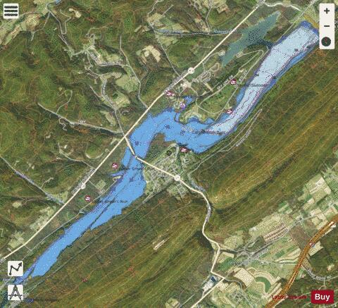
With our Lake Maps App, you get all the great marine chart app features like fishing spots, along with Foster Joseph Sayers Lake depth map. The fishing maps app include HD lake depth contours, along with advanced features found in Fish Finder / Gps Chart Plotter systems, turning your device into a Depth Finder. The Foster Joseph Sayers Lake Navigation App provides advanced features of a Marine Chartplotter including adjusting water level offset and custom depth shading. Fishing spots and depth contours layers are available in most Lake maps. Lake navigation features include advanced instrumentation to gather wind speed direction, water temperature, water depth, and accurate GPS with AIS receivers(using NMEA over TCP/UDP). Autopilot support can be enabled during ‘Goto WayPoint’ and ‘Route Assistance’.
Now i-Boating supports Fishing Points in Foster Joseph Sayers Lake.
Have more questions about the Nautical Chart App? Ask us.
Fishing Info for Foster Joseph Sayers Lake
Foster Joseph Sayers Reservoir is a reservoir located near the borough of Howard, Pennsylvania. The lake is formed due to the damming of Bald Eagle Creek, a tributary of the West Branch Susquehanna River, as well as other smaller creeks. The dam was created in 1971 by the United States Army Corps of Engineers to prevent flooding and continue water quality down stream. The lake is named in honor of Foster Joseph Sayers, a World War II hero from the nearby town of Howard. He was awarded the Medal of Honor for his acts of bravery at the battle near Thionville, France, in 1944. Also in 1971, the formation of Bald Eagle State Park occurred with the formation of the new lake, bringing boating, fishing and swimming to the area. Common fish species in the lake are Sunfish, Catfish, Largemouth and Smallmouth Bass, Yellow Perch, Crappie and Tiger Muskellunge.
More on Wikipedia...Popular fish species in this lake include Largemouth Bass and Panfish.
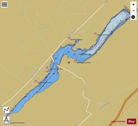
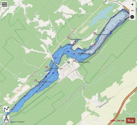
Foster Joseph Sayers Lake Fishing Map Stats | |
| Title | Foster Joseph Sayers Lake |
| Scale | 1:3000 |
| Counties | Centre |
| Nearby Cities | Howard, Eagleville, Blanchard, Jacksonville, Beech Creek, Snydertown, Hublersburg, Nittany, Mingoville, Zion |
| Area * | 1568.44 acres |
| Shoreline * | 19.67 miles |
| Min Longitude | -77.70 |
| Min Latitude | 40.99 |
| Max Longitude | -77.61 |
| Max Latitude | 41.05 |
| Edition Label 1 | |
| Edition Label 2 | |
| Edition Label 3 | |
| Id | US_BM_PA_sayers |
| Country | US |
| Projection | Mercator |
| * some Stats may include nearby/connecting waterbodies | |
|