Lake Havasu fishing map is available as part of iBoating : USA Marine & Fishing App(now supported on multiple platforms including Android, iPhone/iPad, MacBook, and Windows(tablet and phone)/PC based chartplotter.).
With our Lake Maps App, you get all the great marine chart app features like fishing spots, along with Lake Havasu depth map. The fishing maps app include HD lake depth contours, along with advanced features found in Fish Finder / Gps Chart Plotter systems, turning your device into a Depth Finder. The Lake Havasu Navigation App provides advanced features of a Marine Chartplotter including adjusting water level offset and custom depth shading. Fishing spots and depth contours layers are available in most Lake maps. Lake navigation features include advanced instrumentation to gather wind speed direction, water temperature, water depth, and accurate GPS with AIS receivers(using NMEA over TCP/UDP). Autopilot support can be enabled during ‘Goto WayPoint’ and ‘Route Assistance’.
Now i-Boating supports Fishing Points in Lake Havasu.
Have more questions about the Nautical Chart App? Ask us.
Fishing Info for Lake Havasu
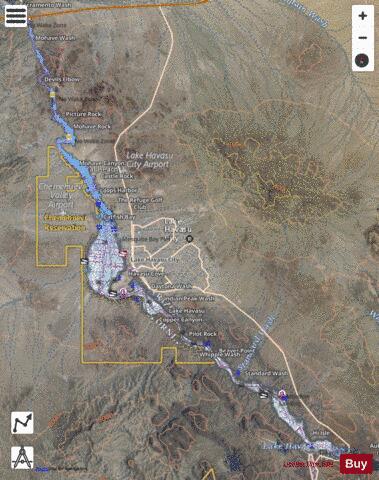
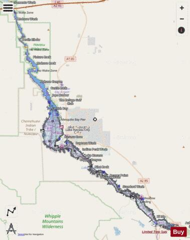
Lake Havasu (/ˈhɑːvəsuː/) is a large reservoir formed by Parker Dam on the Colorado River, on the border between San Bernardino County, California and Mohave County, Arizona, Arizona. Lake Havasu City sits on the Arizona (eastern) side of the lake with its Californian counterpart of Havasu Lake directly across the lake. The reservoir has an available capacity of 619,400 acre-feet (764,000,000 m3). The concrete arch dam was built by the United States Bureau of Reclamation between 1934 and 1938. The lake's primary purpose is to store water for pumping into two aqueducts. Prior to the dam construction, the area was home to the Mojave people. The lake was named (in 1939) after the Mojave word for blue. In the early 19th century, it was frequented by beaver trappers. Spaniards also began to mine the areas along the river.
More on Wikipedia...Popular fish species in this lake include Crappie, Largemouth bass, Razorback sucker, Smallmouth bass, Striped bass and White sturgeon.
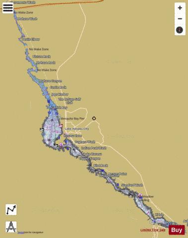
Lake Havasu Fishing Map Stats | |
| Title | Lake Havasu |
| Sailing Clubs in this Chart region | |
| Lake Havasu Yacht Club | |
| Scale | 1:12000 |
| Counties | La Paz, Mohave, San Bernardino |
| Nearby Cities | Topock, Lake Havasu City, Golden Shores, Parker Strip, Cienega Springs, Arizona Village, Bluewater, Needles, Franconia, Parker |
| Area * | 19815.71 acres |
| Shoreline * | 237.75 miles |
| Min Longitude | -114.49 |
| Min Latitude | 34.29 |
| Max Longitude | -114.07 |
| Max Latitude | 34.72 |
| Edition Label 1 | |
| Edition Label 2 | |
| Edition Label 3 | |
| Id | US_CC_CA_lake_havasu_all_ca |
| Country | US |
| Projection | Mercator |
| * some Stats may include nearby/connecting waterbodies | |
|