Rough River Lake fishing map is available as part of iBoating : USA Marine & Fishing App(now supported on multiple platforms including Android, iPhone/iPad, MacBook, and Windows(tablet and phone)/PC based chartplotter.).
With our Lake Maps App, you get all the great marine chart app features like fishing spots, along with Rough River Lake depth map. The fishing maps app include HD lake depth contours, along with advanced features found in Fish Finder / Gps Chart Plotter systems, turning your device into a Depth Finder. The Rough River Lake Navigation App provides advanced features of a Marine Chartplotter including adjusting water level offset and custom depth shading. Fishing spots and depth contours layers are available in most Lake maps. Lake navigation features include advanced instrumentation to gather wind speed direction, water temperature, water depth, and accurate GPS with AIS receivers(using NMEA over TCP/UDP). Autopilot support can be enabled during ‘Goto WayPoint’ and ‘Route Assistance’.
Now i-Boating supports Fishing Points in Rough River Lake.
Have more questions about the Nautical Chart App? Ask us.
Fishing Info for Rough River Lake
The Rough River Lake is a Y-shaped reservoir located in Breckinridge, Hardin, and Grayson counties in Kentucky, about 70 miles southwest of Louisville. This lake was created by the building of a dam, begun in 1955 and completed in 1961, 89.3 miles above the connection between the Rough River and the Green River. The land and water, along with the wildlife, fisheries, and recreational activities, are all managed under the cooperation of the U.S. Army Corps of Engineers and the Commonwealth of Kentucky. A primary attraction is Rough River Dam State Resort Park.
More on Wikipedia...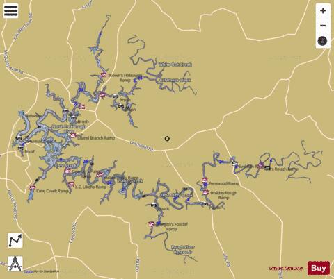
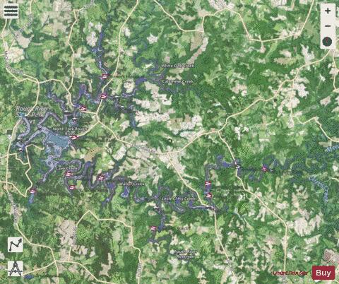
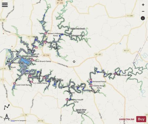
Rough River Lake Fishing Map Stats | |
| Title | Rough River Lake |
| Scale | 1:12000 |
| Counties | Breckinridge, Grayson, Hardin |
| Nearby Cities | McDaniels, Short Creek, Hudson, Glen Dean, Millwood, Leitchfield, McQuady, Clarkson, Hardinsburg, Big Clifty |
| Area * | 4905.23 acres |
| Shoreline * | 223.52 miles |
| Min Longitude | -86.51 |
| Min Latitude | 37.52 |
| Max Longitude | -86.26 |
| Max Latitude | 37.68 |
| Edition Label 1 | |
| Edition Label 2 | |
| Edition Label 3 | |
| Id | US_KY_00507317 |
| Country | US |
| Projection | Mercator |
| * some Stats may include nearby/connecting waterbodies | |
|