Laurel River Lake fishing map is available as part of iBoating : USA Marine & Fishing App(now supported on multiple platforms including Android, iPhone/iPad, MacBook, and Windows(tablet and phone)/PC based chartplotter.).
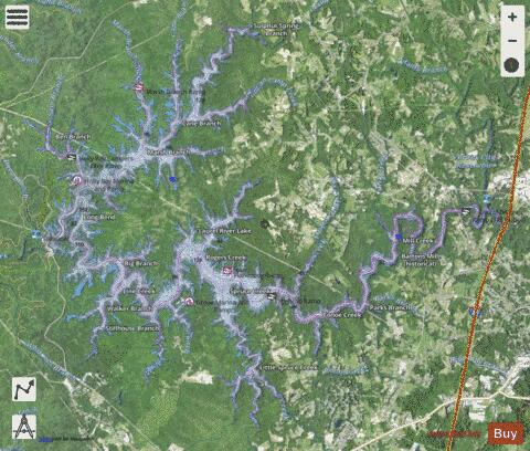
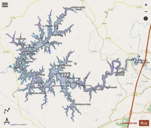
With our Lake Maps App, you get all the great marine chart app features like fishing spots, along with Laurel River Lake depth map. The fishing maps app include HD lake depth contours, along with advanced features found in Fish Finder / Gps Chart Plotter systems, turning your device into a Depth Finder. The Laurel River Lake Navigation App provides advanced features of a Marine Chartplotter including adjusting water level offset and custom depth shading. Fishing spots and depth contours layers are available in most Lake maps. Lake navigation features include advanced instrumentation to gather wind speed direction, water temperature, water depth, and accurate GPS with AIS receivers(using NMEA over TCP/UDP). Autopilot support can be enabled during ‘Goto WayPoint’ and ‘Route Assistance’.
Now i-Boating supports Fishing Points in Laurel River Lake.
Have more questions about the Nautical Chart App? Ask us.
Fishing Info for Laurel River Lake
Laurel River Lake, located west of Corbin, Kentucky, in the U.S., is a reservoir built in 1977 by the U.S. Army Corps of Engineers on the Laurel River, a tributary of the Cumberland River, in the Daniel Boone National Forest. The lake covers parts of Laurel and Whitley counties. The 282 foot (86 m) high dam was built between 1964 and 1974. It is a combination earth and rock-fill dam. Hydropower production began in 1977. As of 2006, it produced an average annual energy of 67 gigawatt hours of hydroelectricity. The Army Corps of Engineers and the Forest Service cooperate on developing recreational facilities around the reservoir. Today most of the lake is managed by the Forest Service as part of Daniel Boone National Forest. The Army Corps of Engineers manages the operation of the dam itself, and runs recreational facilities at the dam. Laurel River Lake's drainage area is 282 square miles (730 km²). The area of the lake changes based on how full it is, but it is about 19 miles (31 km) long, with 206 miles (332 km) of shoreline. Its area ranges from about 5,600 to 6,060 acres (23 to 25 km²), with a maximum flood control size of 6,650 acres (27 km²). The reservoir's storage capacity (volume) also changes, but is about 435,000 acre-feet (537,000,000 m3).
More on Wikipedia...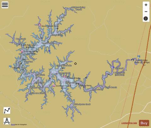
Laurel River Lake Fishing Map Stats | |
| Title | Laurel River Lake |
| Scale | 1:12000 |
| Counties | Laurel, Whitley |
| Nearby Cities | North Corbin, Corbin, Keavy, Woodbine, Gray, Rockholds, Bernstadt, Fletcher, London, Williamsburg |
| Area * | 5729.91 acres |
| Shoreline * | 172.05 miles |
| Min Longitude | -84.28 |
| Min Latitude | 36.91 |
| Max Longitude | -84.11 |
| Max Latitude | 37.02 |
| Edition Label 1 | |
| Edition Label 2 | |
| Edition Label 3 | |
| Id | US_KY_00513266 |
| Country | US |
| Projection | Mercator |
| * some Stats may include nearby/connecting waterbodies | |
|