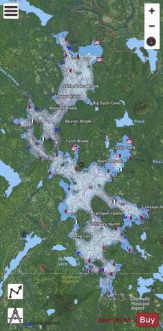
Moosehead Lake fishing map is available as part of iBoating : USA Marine & Fishing App(now supported on multiple platforms including Android, iPhone/iPad, MacBook, and Windows(tablet and phone)/PC based chartplotter.).
With our Lake Maps App, you get all the great marine chart app features like fishing spots, along with Moosehead Lake depth map. The fishing maps app include HD lake depth contours, along with advanced features found in Fish Finder / Gps Chart Plotter systems, turning your device into a Depth Finder. The Moosehead Lake Navigation App provides advanced features of a Marine Chartplotter including adjusting water level offset and custom depth shading. Fishing spots and depth contours layers are available in most Lake maps. Lake navigation features include advanced instrumentation to gather wind speed direction, water temperature, water depth, and accurate GPS with AIS receivers(using NMEA over TCP/UDP). Autopilot support can be enabled during ‘Goto WayPoint’ and ‘Route Assistance’.
Now i-Boating supports Fishing Points in Moosehead Lake.
Have more questions about the Nautical Chart App? Ask us.
Fishing Info for Moosehead Lake
Moosehead Lake is a deep, coldwater lake located in Piscataquis County in Northwestern Maine. It is the second-largest lake in New England, and the largest mountain lake in the eastern United States. Situated in the mostly undeveloped Longfellow Mountains, the lake is the source of the Kennebec River. Several rural Townships border the lake. Greenville is by far the largest town on the lake, with a small downtown area that has banks, shops, and restaurants. There are over 80 islands in the lake, the largest being Sugar Island and Deer Island to the west being the second largest.
More on Wikipedia...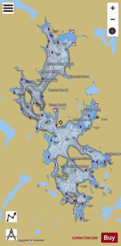

Moosehead Lake Fishing Map Stats | |
| Title | Moosehead Lake |
| Scale | 1:12000 |
| Counties | Piscataquis, Somerset |
| Nearby Cities | North East Carry, Greenville, Rockwood, Shirley Mills, Kokadjo, Monson, Willimantic, Long Pond, Chesuncook, Lake Parlin |
| Area * | 75528.23 acres |
| Shoreline * | 281.14 miles |
| Min Longitude | -69.82 |
| Min Latitude | 45.46 |
| Max Longitude | -69.51 |
| Max Latitude | 45.89 |
| Edition Label 1 | |
| Edition Label 2 | |
| Edition Label 3 | |
| Id | US_ME_00571641 |
| Country | US |
| Projection | Mercator |
| * some Stats may include nearby/connecting waterbodies | |
|