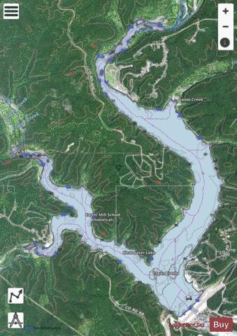
Clearwater Lake fishing map is available as part of iBoating : USA Marine & Fishing App(now supported on multiple platforms including Android, iPhone/iPad, MacBook, and Windows(tablet and phone)/PC based chartplotter.).
With our Lake Maps App, you get all the great marine chart app features like fishing spots, along with Clearwater Lake depth map. The fishing maps app include HD lake depth contours, along with advanced features found in Fish Finder / Gps Chart Plotter systems, turning your device into a Depth Finder. The Clearwater Lake Navigation App provides advanced features of a Marine Chartplotter including adjusting water level offset and custom depth shading. Fishing spots and depth contours layers are available in most Lake maps. Lake navigation features include advanced instrumentation to gather wind speed direction, water temperature, water depth, and accurate GPS with AIS receivers(using NMEA over TCP/UDP). Autopilot support can be enabled during ‘Goto WayPoint’ and ‘Route Assistance’.
Now i-Boating supports Fishing Points in Clearwater Lake.
Have more questions about the Nautical Chart App? Ask us.
Fishing Info for Clearwater Lake
Clearwater Lake is a reservoir on the Black River, six miles (9.7 km) from Piedmont, Missouri. The U.S. Army Corps of Engineers uses Clearwater for flood control in the White and lower Mississippi River Basins. Clearwater Lake was so named on account of its clear, spring-fed water. Construction began in 1940 but was halted temporarily at the advent of World War II. Clearwater Lake Dam opened in 1948 as an earthen and concrete dam, 114 feet (35 m) high. The lake has a surface area of about 2.5 sq mi (6.5 km2). Though recreation was not part of the lake's initial mission, Clearwater now offers boating, swimming, and camping facilities.
More on Wikipedia...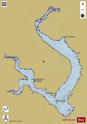
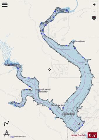
Clearwater Lake Fishing Map Stats | |
| Title | Clearwater Lake |
| Scale | 1:6000 |
| Counties | Reynolds, Wayne |
| Nearby Cities | Piedmont, Leeper, Mill Spring, Des Arc, Ellington, Annapolis, Ellsinore, Patterson, Sabula, Van Buren |
| Area * | 1634.80 acres |
| Shoreline * | 27.31 miles |
| Min Longitude | -90.82 |
| Min Latitude | 37.13 |
| Max Longitude | -90.76 |
| Max Latitude | 37.19 |
| Edition Label 1 | |
| Edition Label 2 | |
| Edition Label 3 | |
| Id | US_MO_00749381 |
| Country | US |
| Projection | Mercator |
| * some Stats may include nearby/connecting waterbodies | |
|