Webster Lake fishing map is available as part of iBoating : USA Marine & Fishing App(now supported on multiple platforms including Android, iPhone/iPad, MacBook, and Windows(tablet and phone)/PC based chartplotter.).
With our Lake Maps App, you get all the great marine chart app features like fishing spots, along with Webster Lake depth map. The fishing maps app include HD lake depth contours, along with advanced features found in Fish Finder / Gps Chart Plotter systems, turning your device into a Depth Finder. The Webster Lake Navigation App provides advanced features of a Marine Chartplotter including adjusting water level offset and custom depth shading. Fishing spots and depth contours layers are available in most Lake maps. Lake navigation features include advanced instrumentation to gather wind speed direction, water temperature, water depth, and accurate GPS with AIS receivers(using NMEA over TCP/UDP). Autopilot support can be enabled during ‘Goto WayPoint’ and ‘Route Assistance’.
Now i-Boating supports Fishing Points in Webster Lake.
Have more questions about the Nautical Chart App? Ask us.
Fishing Info for Webster Lake
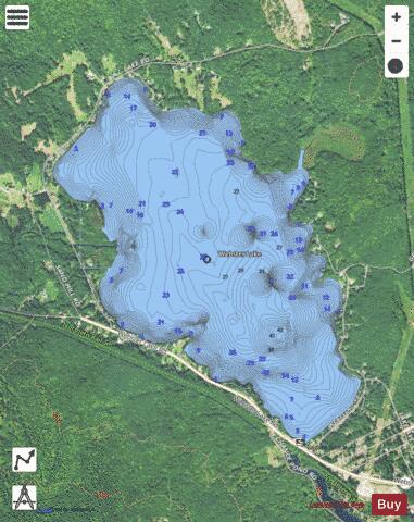
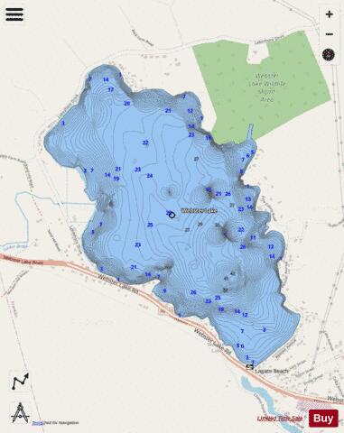
Webster Lake is a 606-acre (2.45 km2) water body in West Franklin, a village of Franklin in Merrimack County in the central portion of the U.S. state of New Hampshire. Water from Webster Lake flows to the Pemigewasset River shortly above its confluence with the Winnipesaukee River to form the Merrimack. Webster Lake has two public beaches operated by the city of Franklin, one on either side of the lake. Webster Lake is surrounded by forests, and roads follow most of the lakeshore, allowing frequent views. There is boating access adjacent to Lagace Beach on New Hampshire Route 11. The lake is classified as a warmwater fishery, with observed species including rainbow trout, brown trout, smallmouth and largemouth bass, chain pickerel, horned pout, and white perch.
More on Wikipedia...Popular fish species in this lake include Brown bullhead, Chain pickerel, Largemouth bass, Rainbow trout and Smallmouth bass.
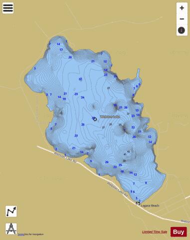
Webster Lake Fishing Map Stats | |
| Title | Webster Lake |
| Scale | 1:3000 |
| Counties | Merrimack |
| Nearby Cities | Franklin, Hill, Tilton Northfield, Northfield, Salisbury, Tilton, Sanbornton, Bristol, Andover, New Hampton |
| Area * | 606.09 acres |
| Shoreline * | 5.31 miles |
| Min Longitude | -71.70 |
| Min Latitude | 43.46 |
| Max Longitude | -71.67 |
| Max Latitude | 43.48 |
| Edition Label 1 | |
| Edition Label 2 | |
| Edition Label 3 | |
| Id | US_NH_00870704 |
| Country | US |
| Projection | Mercator |
| * some Stats may include nearby/connecting waterbodies | |
|