Wahtum Lake fishing map is available as part of iBoating : USA Marine & Fishing App(now supported on multiple platforms including Android, iPhone/iPad, MacBook, and Windows(tablet and phone)/PC based chartplotter.).
With our Lake Maps App, you get all the great marine chart app features like fishing spots, along with Wahtum Lake depth map. The fishing maps app include HD lake depth contours, along with advanced features found in Fish Finder / Gps Chart Plotter systems, turning your device into a Depth Finder. The Wahtum Lake Navigation App provides advanced features of a Marine Chartplotter including adjusting water level offset and custom depth shading. Fishing spots and depth contours layers are available in most Lake maps. Lake navigation features include advanced instrumentation to gather wind speed direction, water temperature, water depth, and accurate GPS with AIS receivers(using NMEA over TCP/UDP). Autopilot support can be enabled during ‘Goto WayPoint’ and ‘Route Assistance’.
Now i-Boating supports Fishing Points in Wahtum Lake.
Have more questions about the Nautical Chart App? Ask us.
Fishing Info for Wahtum Lake
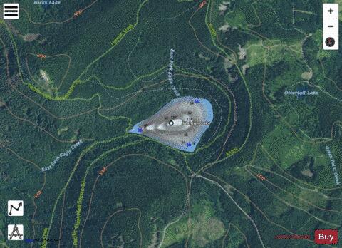
Wahtum Lake is a lake in Hood River County, Oregon, United States, in the Mark O. Hatfield Wilderness of the Mount Hood National Forest. "Wahtum" comes from the Sahaptin language, and means "pond' or "body of water.". The largest lake within the boundaries of the Columbia River Gorge, it is the source of the East Fork of Eagle Creek, and at 184 feet (56 m) is the deepest lake in the Mount Hood National Forest. At an elevation of 3,727 feet (1,136 m), the lake is located in a cirque formed by glacial erosion. Less than 0.25 miles from a trailhead reachable by paved road, Wahtum Lake is a popular recreation destination. Several campsites exist at the trailhead and there are backcountry sites on the shore of the lake itself. A dense network of trails exists around the lake, with several leading 4,000 feet (1,200 m) down to the Columbia River. The Pacific Crest Trail wraps around Wahtum Lake, while the Eagle Creek Trail #440 — the most popular trail in the Gorge — has its upper terminus at Wahtum Lake.
More on Wikipedia...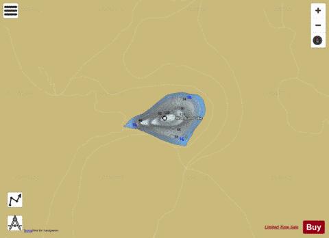

Wahtum Lake Fishing Map Stats | |
| Title | Wahtum Lake |
| Scale | 1:3000 |
| Counties | Hood River |
| Nearby Cities | Cascade Locks, Stevenson, Carson, Dee, North Bonneville, Parkdale, Mount Hood, Odell, Hood, Rhododendron |
| Area * | 65.19 acres |
| Shoreline * | 1.37 miles |
| Min Longitude | -121.80 |
| Min Latitude | 45.58 |
| Max Longitude | -121.79 |
| Max Latitude | 45.58 |
| Edition Label 1 | |
| Edition Label 2 | |
| Edition Label 3 | |
| Id | US_OR_ordfw_wahtum_lake |
| Country | US |
| Projection | Mercator |
| * some Stats may include nearby/connecting waterbodies | |
|