Keystone Lake fishing map is available as part of iBoating : USA Marine & Fishing App(now supported on multiple platforms including Android, iPhone/iPad, MacBook, and Windows(tablet and phone)/PC based chartplotter.).
With our Lake Maps App, you get all the great marine chart app features like fishing spots, along with Keystone Lake depth map. The fishing maps app include HD lake depth contours, along with advanced features found in Fish Finder / Gps Chart Plotter systems, turning your device into a Depth Finder. The Keystone Lake Navigation App provides advanced features of a Marine Chartplotter including adjusting water level offset and custom depth shading. Fishing spots and depth contours layers are available in most Lake maps. Lake navigation features include advanced instrumentation to gather wind speed direction, water temperature, water depth, and accurate GPS with AIS receivers(using NMEA over TCP/UDP). Autopilot support can be enabled during ‘Goto WayPoint’ and ‘Route Assistance’.
Now i-Boating supports Fishing Points in Keystone Lake.
Have more questions about the Nautical Chart App? Ask us.
Fishing Info for Keystone Lake
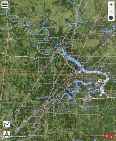
Keystone Lake is a reservoir in northeastern Oklahoma on the Arkansas and Cimarron rivers. It is located upstream about 23 miles (37 km) from Tulsa. It was created in 1968 when the Keystone Dam was completed. The primary purposes are: flood control, hydroelectric power generation, wildlife management and recreation.
More on Wikipedia...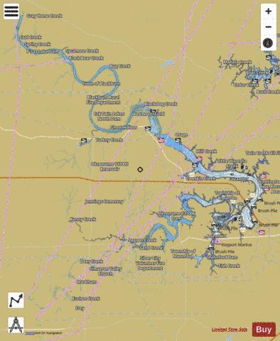
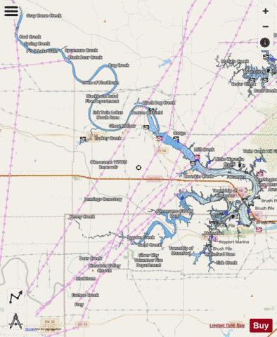
Keystone Lake Fishing Map Stats | |
| Title | Keystone Lake |
| Sailing Clubs in this Chart region | |
| Windycrest Sailing Club | |
| Scale | 1:24000 |
| Counties | Creek, Osage, Pawnee, Payne, Tulsa |
| Nearby Cities | Prue, Osage, Shady Grove, Lotsee, Oilton, Westport, Mannford, Cleveland, Terlton, Blackburn |
| Area * | 27762.55 acres |
| Shoreline * | 474.02 miles |
| Min Longitude | -96.75 |
| Min Latitude | 35.97 |
| Max Longitude | -96.20 |
| Max Latitude | 36.49 |
| Edition Label 1 | |
| Edition Label 2 | |
| Edition Label 3 | |
| Id | US_TU_OK_keystone |
| Country | US |
| Projection | Mercator |
| * some Stats may include nearby/connecting waterbodies | |
|