Hugo_OK fishing map is available as part of iBoating : USA Marine & Fishing App(now supported on multiple platforms including Android, iPhone/iPad, MacBook, and Windows(tablet and phone)/PC based chartplotter.).
With our Lake Maps App, you get all the great marine chart app features like fishing spots, along with Hugo_OK lake depth map. The fishing maps app include HD lake depth contours, along with advanced features found in Fish Finder / Gps Chart Plotter systems, turning your device into a Depth Finder. The Hugo_OK Navigation App provides advanced features of a Marine Chartplotter including adjusting water level offset and custom depth shading. Fishing spots and depth contours layers are available in most Lake maps. Lake navigation features include advanced instrumentation to gather wind speed direction, water temperature, water depth, and accurate GPS with AIS receivers(using NMEA over TCP/UDP). Autopilot support can be enabled during ‘Goto WayPoint’ and ‘Route Assistance’.
Now i-Boating supports Fishing Points in Hugo_OK.
Have more questions about the Nautical Chart App? Ask us.
Fishing Info for Hugo_OK
Hugo Lake is manmade lake located 7 miles (11 km) east of Hugo, in Choctaw County, Oklahoma, United States. It is formed by Hugo Lake Dam on the Kiamichi River 18 miles (29 km) upstream from the Red River. The dam is visible from U.S. Route 70, which crosses its spillway just west of Sawyer. Lake Hugo features approximately 110 miles (180 km) of shoreline and covers over 13,250 acres (53.6 km2), or 20 square miles (52 km2). Its normal pool elevation is 404.5 feet (123.3 m) above sea level and its normal storage capacity is 157,600 acre-feet (194,400,000 m3). At flood stage its elevation is at 437.5 feet (133.4 m) above sea level and it is capable of storing 966,700 acre-feet (1.1924×10⁹ m3) of flood waters. The lake's primary functions are to provide flood control, water storage, and recreational opportunities. The nearest major cities to Lake Hugo are Fort Smith, Arkansas (101 miles), Dallas, Texas (114 miles) and Oklahoma City, Oklahoma(151 miles).
More on Wikipedia...Popular fish species in this lake include Crappie.
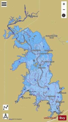
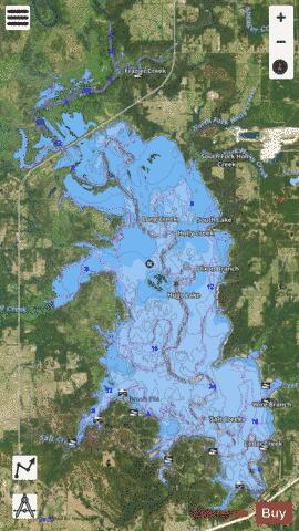
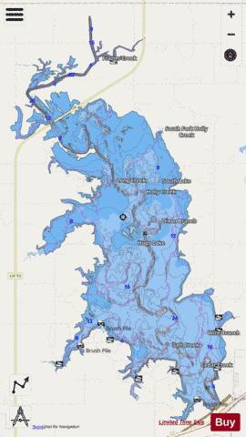
Hugo_OK Fishing Map Stats | |
| Title | Hugo_OK |
| Scale | 1:24000 |
| Counties | Choctaw |
| Nearby Cities | Sawyer, Spencerville, Rattan, Hugo, Fort Towson, Speer, Grant, Swink, Arthur City, Finley |
| Area * | 12338.89 acres |
| Shoreline * | 108.54 miles |
| Min Longitude | -95.47 |
| Min Latitude | 34.01 |
| Max Longitude | -95.37 |
| Max Latitude | 34.15 |
| Edition Label 1 | |
| Edition Label 2 | |
| Edition Label 3 | |
| Id | US_TX_hugo_ok |
| Country | US |
| Projection | Mercator |
| * some Stats may include nearby/connecting waterbodies | |
|