Bitter Lake fishing map is available as part of iBoating : USA Marine & Fishing App(now supported on multiple platforms including Android, iPhone/iPad, MacBook, and Windows(tablet and phone)/PC based chartplotter.).
With our Lake Maps App, you get all the great marine chart app features like fishing spots, along with Bitter Lake depth map. The fishing maps app include HD lake depth contours, along with advanced features found in Fish Finder / Gps Chart Plotter systems, turning your device into a Depth Finder. The Bitter Lake Navigation App provides advanced features of a Marine Chartplotter including adjusting water level offset and custom depth shading. Fishing spots and depth contours layers are available in most Lake maps. Lake navigation features include advanced instrumentation to gather wind speed direction, water temperature, water depth, and accurate GPS with AIS receivers(using NMEA over TCP/UDP). Autopilot support can be enabled during ‘Goto WayPoint’ and ‘Route Assistance’.
Now i-Boating supports Fishing Points in Bitter Lake.
Have more questions about the Nautical Chart App? Ask us.
Fishing Info for Bitter Lake
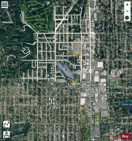
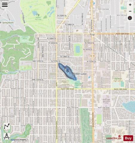
Bitter Lake is a small lake in northwest Seattle, Washington, USA. The lake covers 19 acres (77,000 m2), with a mean depth of 16 feet (4.9 m) and a maximum depth of 31 feet (9.4 m). Until 1913, a sawmill was located at its southwest corner. Tannic acid from logs dumped into the lake gave its water a bitter taste and the lake itself a name. The Duwamish called the lake "Blackcaps on the Sides" (Lushootseed: cHálqWadee), denoting the blackcap (Rubus leucodermis) plants that grew along the shores. It is a glacial lake with its basin having been dug 15,000 years ago by the Puget Lobe of the Cordilleran Ice Sheet, which also created Lake Washington, Union, Green, and Haller Lakes. The Seattle-to-Everett Interurban streetcar reached the lake in 1906, and the Bitter Lake neighborhood was annexed by Seattle in 1954. The lake is situated between Greenwood Avenue North to the west, Linden Avenue North to the east, North 137th Street to the north, and North 130th Street to the south. Bitter Lake drains through a piped outlet at its southeast end that eventually flows into Lake Union.
More on Wikipedia...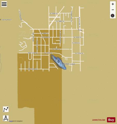
Bitter Lake Fishing Map Stats | |
| Title | Bitter Lake |
| Scale | 1:6000 |
| Counties | King |
| Nearby Cities | Shoreline, Richmond Highlands, Ridgecrest, North City, Richmond Beach, Meridian, Sheridan Beach, Woodway, Mountlake Terrace, Lake Forest Park |
| Area * | 15.81 acres |
| Shoreline * | 0.77 miles |
| Min Longitude | -122.36 |
| Min Latitude | 47.72 |
| Max Longitude | -122.35 |
| Max Latitude | 47.73 |
| Edition Label 1 | |
| Edition Label 2 | |
| Edition Label 3 | |
| Id | US_WA_01503393 |
| Country | US |
| Projection | Mercator |
| * some Stats may include nearby/connecting waterbodies | |
|