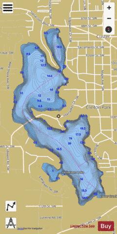
Steilacoom Lake fishing map is available as part of iBoating : USA Marine & Fishing App(now supported on multiple platforms including Android, iPhone/iPad, MacBook, and Windows(tablet and phone)/PC based chartplotter.).
With our Lake Maps App, you get all the great marine chart app features like fishing spots, along with Steilacoom Lake depth map. The fishing maps app include HD lake depth contours, along with advanced features found in Fish Finder / Gps Chart Plotter systems, turning your device into a Depth Finder. The Steilacoom Lake Navigation App provides advanced features of a Marine Chartplotter including adjusting water level offset and custom depth shading. Fishing spots and depth contours layers are available in most Lake maps. Lake navigation features include advanced instrumentation to gather wind speed direction, water temperature, water depth, and accurate GPS with AIS receivers(using NMEA over TCP/UDP). Autopilot support can be enabled during ‘Goto WayPoint’ and ‘Route Assistance’.
Now i-Boating supports Fishing Points in Steilacoom Lake.
Have more questions about the Nautical Chart App? Ask us.
Fishing Info for Steilacoom Lake
Lake Steilacoom is a reservoir approximately 4 km (2.5 mi) southwest of Tacoma in Pierce County, Washington, United States. Its boundaries lie entirely within the city of Lakewood, Washington. The reservoir covers approximately 306 acres (1,240,000 m2), has a mean depth of 11 feet (3.4 m) and a maximum depth of 20 feet (6.1 m). Lake Steilacoom is a freshwater lake and drains into Puget Sound via Chambers Creek, which begins at its northern tip. The lake is fed at its southeastern end by two creeks: , which originates in springs below what is now Lakewood Towne Center, as well as Clover Creek which flows from its source near Frederickson to the lake. The reservoir was created in 1853 when Andrew Byrd built a dam across Chambers Creek, flooding what had previously been a small pond in a wetland. The dam was used for his sawmill (also built in 1853) and a grist mill (100 yards downstream, in 1857). A public boat launch can be found on the eastern shore in Edgewater Park. The smaller pond was known as Lake Wyatchew prior to the dam's installation, and was briefly known later as Byrd's lake. The Rhodesleigh mansion is located by the lake. The Nisqually Indians say this lake was possessed by an evil female monster known as Whe-atchee. Legends of the creature attacking people go back over a century. To this day, Nisqually refuse to fish or swim here.
More on Wikipedia...Steilacoom Lake Fishing Map Stats | |
| Title | Steilacoom Lake |
| Scale | 1:12000 |
| Counties | Pierce |
| Nearby Cities | Lakewood, Lake City, Lakeview, Tillicum, Sunset Beach, Steilacoom, University Place, Fircrest, Parkland, Wollochet |
| Area * | 306.14 acres |
| Shoreline * | 5.99 miles |
| Min Longitude | -122.54 |
| Min Latitude | 47.16 |
| Max Longitude | -122.53 |
| Max Latitude | 47.18 |
| Edition Label 1 | |
| Edition Label 2 | |
| Edition Label 3 | |
| Id | US_WA_01513482 |
| Country | US |
| Projection | Mercator |
| * some Stats may include nearby/connecting waterbodies | |
|


